Patchogue, New York Map and Directory
Regional Directory > States Menu > New York
 According to the United States Census Bureau, Patchogue is a Village that is located in Suffolk County, New York at 40.77 degrees North and 73.02 degrees West.
The village's time zone is America/New York, and the village's primary telephone area code is 631.
The land area of Patchogue is about 2.26 square miles, whereas the water area of the village is about 0.26 square miles.
Suffolk County's land area is about 912 square miles, so the village occupies about 0.2 percent of the county's total land area.
According to the United States Census Bureau, Patchogue is a Village that is located in Suffolk County, New York at 40.77 degrees North and 73.02 degrees West.
The village's time zone is America/New York, and the village's primary telephone area code is 631.
The land area of Patchogue is about 2.26 square miles, whereas the water area of the village is about 0.26 square miles.
Suffolk County's land area is about 912 square miles, so the village occupies about 0.2 percent of the county's total land area.
The Census Bureau estimates that Patchogue had about 12,321 residents in 2019, which is approximately 5,452 people per square mile of land area.
According to recent American Community Survey data, the median household income in Patchogue was about $71,235 per year.
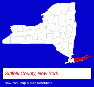
The New York counties map at upper right shows Suffolk County, highlighted in red. Use the menu below to display interactive maps of Patchogue, either in a frame on this page or in full-screen mode.
Use the menu below to display categorized Patchogue directories.
| Patchogue Products and Services Directory | ||
|---|---|---|
| Attorneys | Printing and Publishing | Restaurants |
| Visual Arts | ||
Selected Patchogue, New York Listings
These randomly selected Patchogue listings provide some insight into the village's cultural environment and economic climate.- Building Materials & Supplies Dealers
- Cabinet Dealers
- Steak Restaurants
- Jewelers
- Fireplaces & Accessories Retail
- Fireplace & Chimney Building & Repair
- Window Glass Coating & Tinting
- Window Coverings Retail
- Custom Car Parts & Accessories
- Home Improvement & Maintenance
- Kitchen & Bathroom Remodeling
- Bathroom Planning & Remodeling
- Kitchen Design & Remodeling Services
- Bathroom & Kitchen Contractors
- Photography
- Professional Photographers
- Plastic & Plastic Products Wholesale & Manufacturers
- Auto Insurance
- Auto Insurance
- Property & Casualty Insurance
- Accountants
- Certified Public Accountants
- Travel Agents
- Beverages Retail
- Coffee & Tea Wholesale & Manufacturers
Nearby New York Cities and Towns *
- Bayport (1) - Bayport, New York information and maps.
- Bohemia (8) - Bohemia, New York demographics and maps.
- Hauppauge (11) - Hauppauge, New York demographics and directory.
- Holbrook (1) - Holbrook, New York information and maps.
- Medford (6) - Medford, New York demographics and maps.
- Ronkonkoma (6) - Ronkonkoma, New York demographics and maps.
- Sayville (2) - Sayville, New York information and maps.
Large and Mid-size Cities in Nearby States
- Westport, Connecticut (11) - Westport, CT demographics and maps.
- Bridgeport, Connecticut (10) - Bridgeport, CT demographics and maps.
- Milford, Connecticut (14) - Milford, CT demographics and directory.
* Parenthesized numbers indicate economic activity levels.
Copyright © 2011-2026 RegionalDirectory.us. All rights reserved.