Red Hook, New York Map and Directory
Regional Directory > States Menu > New York
 According to the United States Census Bureau, Red Hook is a Village that is located in Dutchess County, New York at 42.00 degrees North and 73.88 degrees West.
The village's time zone is America/New York, and the village's primary telephone area code is 845.
The land area of Red Hook is about 1.10 square miles, whereas the water area of the village is about 0.01 square miles.
Dutchess County's land area is about 796 square miles, so the village occupies about 0.1 percent of the county's total land area.
According to the United States Census Bureau, Red Hook is a Village that is located in Dutchess County, New York at 42.00 degrees North and 73.88 degrees West.
The village's time zone is America/New York, and the village's primary telephone area code is 845.
The land area of Red Hook is about 1.10 square miles, whereas the water area of the village is about 0.01 square miles.
Dutchess County's land area is about 796 square miles, so the village occupies about 0.1 percent of the county's total land area.
The Census Bureau estimates that Red Hook had about 11,154 residents in 2019, which is approximately 10,140 people per square mile of land area.
According to recent American Community Survey data, the median household income in Red Hook was about $85,881 per year.
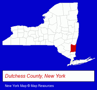
The New York counties map at upper right shows Dutchess County, highlighted in red. Use the menu below to display interactive maps of Red Hook, either in a frame on this page or in full-screen mode.
Use the menu below to display categorized Red Hook directories.
| Red Hook Directory Page: | Restaurants |
|---|
Selected Red Hook, New York Listings
These Red Hook listings provide some insight into the village's cultural environment and economic climate.- Insulation Contractors
- Sound Proofing
- Picture Frames Retail
- Caterers
- Banquet Facilities
- Event Planning
- Party Planning
- Excavation Contractors
- Steak Restaurants
- Podiatry Physicians & Surgeons
- Art Schools
- Security Systems & Services
- Burglar Alarm Systems & Monitoring
- Closed Circuit Television Equipment & Security Systems
- Alarm Services
- Financial Services
- Accounting, Auditing & Bookkeeping Services
- Bookkeeping Services
- Sporting Goods Dealers
- Airports
- Dentists
- Oral Surgeons
- Security Systems & Services
- Fire Departments
- Fire Department Equipment & Supplies
- Builders & Contractors
- Building Contractors
Nearby New York Cities and Towns *
- Hudson (5) - Hudson, New York demographics and maps.
- Kingston (10) - Kingston, New York demographics and directory.
- Poughkeepsie (17) - Poughkeepsie, New York solutions directory and maps.
- Rhinebeck (3) - Rhinebeck, New York information and maps.
* Parenthesized numbers indicate economic activity levels.
Copyright © 2011-2026 RegionalDirectory.us. All rights reserved.