Schenectady, New York Map and Directory
Regional Directory > States Menu > New York
 According to the United States Census Bureau, Schenectady is a City that is located in Schenectady County, New York at 42.81 degrees North and 73.94 degrees West.
The city's time zone is America/New York, and the city's primary telephone area code is 518.
The land area of Schenectady is about 10.79 square miles, whereas the water area of the city is about 0.19 square miles.
Schenectady County's land area is about 205 square miles, so the city occupies about 5.3 percent of the county's total land area.
According to the United States Census Bureau, Schenectady is a City that is located in Schenectady County, New York at 42.81 degrees North and 73.94 degrees West.
The city's time zone is America/New York, and the city's primary telephone area code is 518.
The land area of Schenectady is about 10.79 square miles, whereas the water area of the city is about 0.19 square miles.
Schenectady County's land area is about 205 square miles, so the city occupies about 5.3 percent of the county's total land area.
The Census Bureau estimates that Schenectady had about 65,273 residents in 2019, which is approximately 6,049 people per square mile of land area.
According to recent American Community Survey data, the median household income in Schenectady was about $45,438 per year.
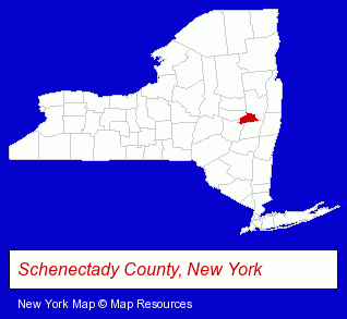
The New York counties map at upper right shows Schenectady County, highlighted in red. Use the menu below to display interactive maps of Schenectady, either in a frame on this page or in full-screen mode.
Use the menu below to display categorized Schenectady directories.
| Schenectady Products and Services Directory | ||
|---|---|---|
| Attorneys | Auto Service | Building Contractors |
| Building Materials | Clinics | Dentists |
| Home Improvement | Libraries | Physicians |
| Restaurants | Schools | Visual Arts |
Selected Schenectady, New York Listings
These randomly selected Schenectady listings provide some insight into the city's cultural environment and economic climate.- Banks
- Accounting, Auditing & Bookkeeping Services
- Certified Public Accountants
- Tax Return Preparation
- Accounting & Tax Consultants
- Chemicals Wholesale & Manufacturers
- Photography
- Professional Photographers
- Civic Clubs & Organizations
- Banquet Facilities
- Private Golf Courses
- Landscape Contractors
- Movers
- Household Goods Moving & Storage
- Full Service Moving & Storage
- Furniture Movers
- Coffee & Tea Shops
- Industrial Equipment & Supplies Dealers
- Industrial Equipment & Supplies Wholesale & Manufacturers
- Auto Parts Retail
- Industrial Equipment Parts & Accessories Wholesale & Manufacturers
- Fuel & Oil Filters
- Industrial Equipment & Supplies Dealers
- Auto Parts Retail
Nearby New York Cities and Towns *
- Albany (41) - Albany, New York products & services directory.
- Amsterdam (1) - Amsterdam, New York information and maps.
- Ballston Spa (4) - Ballston Spa, New York information and maps.
- Berne (1) - Berne, New York information and maps.
- Clifton Park (7) - Clifton Park, New York demographics and maps.
- Troy (11) - Troy, New York demographics and directory.
- Voorheesville (1) - Voorheesville, New York information and maps.
* Parenthesized numbers indicate economic activity levels.
Copyright © 2011-2026 RegionalDirectory.us. All rights reserved.