Ashland, Ohio Map and Directory
Regional Directory > States Menu > Ohio
 According to the United States Census Bureau, Ashland is a City that is located in Ashland County, Ohio at 40.87 degrees North and 82.32 degrees West.
The city's time zone is America/New York, and the city's primary telephone area code is 419.
The land area of Ashland is about 11.17 square miles, whereas the water area of the city is about 0.06 square miles.
Ashland County's land area is about 423 square miles, so the city occupies about 2.6 percent of the county's total land area.
According to the United States Census Bureau, Ashland is a City that is located in Ashland County, Ohio at 40.87 degrees North and 82.32 degrees West.
The city's time zone is America/New York, and the city's primary telephone area code is 419.
The land area of Ashland is about 11.17 square miles, whereas the water area of the city is about 0.06 square miles.
Ashland County's land area is about 423 square miles, so the city occupies about 2.6 percent of the county's total land area.
The Census Bureau estimates that Ashland had about 20,275 residents in 2019, which is approximately 1,815 people per square mile of land area.
According to recent American Community Survey data, the median household income in Ashland was about $47,869 per year.
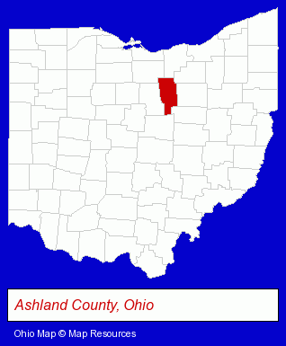
The Ohio counties map at upper right shows Ashland County, highlighted in red. Use the menu below to display interactive maps of Ashland, either in a frame on this page or in full-screen mode.
Use the menu below to display categorized Ashland directories.
| Ashland Products and Services Directory | |
|---|---|
| Home Improvement | Restaurants |
Selected Ashland, Ohio Listings
These representative Ashland listings provide some insight into the city's cultural environment and economic climate.- Advertising
- Advertising & Promotional Product Dealers
- Advertising Specialties Wholesale & Manufacturers
- Advertising & Promotional Gifts
- Clinics & Medical Centers
- Clinics
- Family Planning
- Family Planning & Birth Control Clinics
- Optometrists
- Contact Lenses
- Libraries
- Auto Service & Repair
- Towing
- Pizza Restaurants
- Alternative Medicine
- Chiropractors
- Alternative Medicine Practitioners
- Certified & Registered Massage Therapists
- Boxes Wholesale & Manufacturers
- Paperboard Boxes Wholesale & Manufacturers
- Box Manufacturer Equipment & Supplies
- Plastic & Plastic Products Wholesale & Manufacturers
- Visual Arts
- Photography
- Professional Photographers
- Portrait Photographers
- Photographers Commercial & Industrial
- Industrial Equipment & Supplies Dealers
- Industrial Equipment & Supplies Wholesale & Manufacturers
- Electric & Electronic Equipment & Supplies
- Consumer Electronics Stores
- Electric Equipment & Supplies Wholesale & Manufacturers
- Visual Arts
- Art Galleries & Dealers
- Churches
- Restaurants
- Church & Religious Associations & Organizations
- Banquet Facilities
- Convention & Meeting Facilities & Services
- Building & Home Construction
- Utilities
- Excavation Contractors
- Garbage & Junk Removal
- Garbage Containers
- Home Improvement & Maintenance
- Kitchen & Bathroom Remodeling
- Bathtubs & Sinks Repair & Refinishing
- Auctions
- Auctioneers & Auction Houses
Nearby Ohio Cities and Towns *
- Mansfield (7) - Mansfield, Ohio demographics and maps.
- Medina (9) - Medina, Ohio demographics and directory.
- Wooster (8) - Wooster, Ohio demographics and maps.
* Parenthesized numbers indicate economic activity levels.
Copyright © 2011-2026 RegionalDirectory.us. All rights reserved.