Lebanon, Ohio Map and Directory
Regional Directory > States Menu > Ohio
 According to the United States Census Bureau, Lebanon is a City that is located in Warren County, Ohio at 39.44 degrees North and 84.20 degrees West.
The city's time zone is America/New York, and the city's primary telephone area code is 513.
The land area of Lebanon is about 12.89 square miles, whereas the water area of the city is about 0.01 square miles.
Warren County's land area is about 401 square miles, so the city occupies about 3.2 percent of the county's total land area.
According to the United States Census Bureau, Lebanon is a City that is located in Warren County, Ohio at 39.44 degrees North and 84.20 degrees West.
The city's time zone is America/New York, and the city's primary telephone area code is 513.
The land area of Lebanon is about 12.89 square miles, whereas the water area of the city is about 0.01 square miles.
Warren County's land area is about 401 square miles, so the city occupies about 3.2 percent of the county's total land area.
The Census Bureau estimates that Lebanon had about 20,659 residents in 2019, which is approximately 1,603 people per square mile of land area.
According to recent American Community Survey data, the median household income in Lebanon was about $65,477 per year.
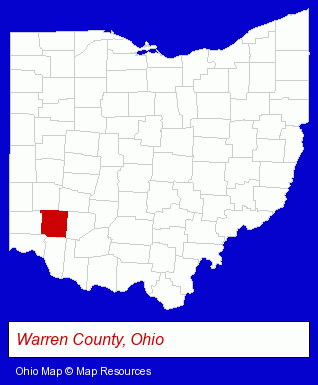
The Ohio counties map at upper right shows Warren County, highlighted in red. Use the menu below to display interactive maps of Lebanon, either in a frame on this page or in full-screen mode.
Use the menu below to display categorized Lebanon directories.
| Lebanon Products and Services Directory | ||
|---|---|---|
| Home Improvement | Moving and Storage | Schools |
Selected Lebanon, Ohio Listings
These representative Lebanon listings provide some insight into the city's cultural environment and economic climate.- Florists
- Floral & Balloon Arrangements
- Beauty Salons
- Hair Care & Treatment
- Barbers
- Skin Care Products
- Driver Training
- Defensive Driving Instruction
- Clinics & Medical Centers
- Veterinarians
- Animal Hospitals
- Restaurants
- Lodging
- Hotels
- Motels
- Candy & Confectionery Retail
- Baking Products
- Building & Home Construction
- Heating Contractors
- Heating & Ventilating Contractors
- Grocery Stores & Supermarkets
- Fruits & Vegetables Retail
- Fruits & Vegetables Wholesale
- Elementary & Secondary Education
- Elementary Schools
- Preschools & Kindergartens
- Private Schools
- Libraries
- Insurance
- Industrial Equipment & Supplies Dealers
- Industrial Equipment & Supplies Wholesale & Manufacturers
- Industrial Equipment Parts & Accessories Wholesale & Manufacturers
- Picture Frames Retail
- Funeral Services
- Funeral Homes & Directors
- Cemeteries & Memorial Parks
- Cemeteries & Crematories
- Cremation Services
- Vocational Education
- Business Education
- Tires Retail
- Industrial Equipment & Supplies Wholesale & Manufacturers
- Party Equipment & Supplies Sales & Rental
- Industrial Equipment Parts & Accessories Wholesale & Manufacturers
- Plastic Molders
- Disposable Products Retail
Nearby Ohio Cities and Towns *
- Loveland (3) - Loveland, Ohio information and maps.
- Middletown (4) - Middletown, Ohio information and maps.
- West Chester (7) - West Chester, Ohio demographics and maps.
* Parenthesized numbers indicate economic activity levels.
Copyright © 2011-2026 RegionalDirectory.us. All rights reserved.