North Olmsted, Ohio Map and Directory
Regional Directory > States Menu > Ohio
 According to the United States Census Bureau, North Olmsted is a City that is located in Cuyahoga County, Ohio at 41.42 degrees North and 81.92 degrees West.
The city's time zone is America/New York, and the city's primary telephone area code is 440.
The land area of North Olmsted is about 11.67 square miles, whereas the water area of the city is about 0.00 square miles.
Cuyahoga County's land area is about 457 square miles, so the city occupies about 2.6 percent of the county's total land area.
According to the United States Census Bureau, North Olmsted is a City that is located in Cuyahoga County, Ohio at 41.42 degrees North and 81.92 degrees West.
The city's time zone is America/New York, and the city's primary telephone area code is 440.
The land area of North Olmsted is about 11.67 square miles, whereas the water area of the city is about 0.00 square miles.
Cuyahoga County's land area is about 457 square miles, so the city occupies about 2.6 percent of the county's total land area.
The Census Bureau estimates that North Olmsted had about 31,341 residents in 2019, which is approximately 2,686 people per square mile of land area.
According to recent American Community Survey data, the median household income in North Olmsted was about $64,236 per year.
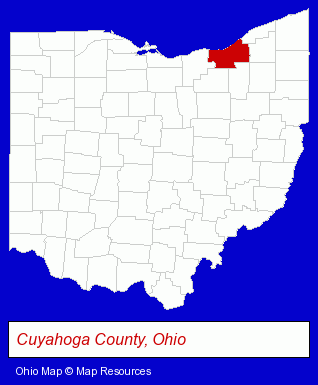
The Ohio counties map at upper right shows Cuyahoga County, highlighted in red. Use the menu below to display interactive maps of North Olmsted, either in a frame on this page or in full-screen mode.
Use the menu below to display categorized North Olmsted directories.
| North Olmsted Directory Page: | Home Improvement |
|---|
Selected North Olmsted, Ohio Listings
These North Olmsted listings provide some insight into the city's cultural environment and economic climate.- Sports & Recreation Facilities
- Bowling Alleys
- Billiard & Pool Halls
- Sporting Goods Dealers
- Soccer
- Soccer Equipment & Supplies
- Accountants
- Public Accountants
- Certified Public Accountants
- Financial Services
- Insurance
- Financial Planning Consultants & Services
- Hair Care & Treatment
- Hair Replacement
- Wigs & Hairpieces Retail
- Health & Beauty Aids Retail
- Restaurants
- Bar & Grill Restaurants
- Mexican Restaurants
- Family Restaurants
- Bookstores
- Hobbies
- Comic Books
- Insurance
- Building Materials & Supplies Dealers
- Building Materials & Supplies Wholesale & Manufacturers
- Landscape Equipment & Supplies Dealers
- Mulch
Nearby Ohio Cities and Towns *
- Avon (2) - Avon, Ohio information and maps.
- Berea (2) - Berea, Ohio information and maps.
- Brook Park (2) - Brook Park, Ohio information and maps.
- Lakewood (2) - Lakewood, Ohio information and maps.
- Rocky River (3) - Rocky River, Ohio information and maps.
- Strongsville (5) - Strongsville, Ohio demographics and maps.
- Westlake (7) - Westlake, Ohio demographics and maps.
* Parenthesized numbers indicate economic activity levels.
Copyright © 2011-2026 RegionalDirectory.us. All rights reserved.