Port Clinton, Ohio Map and Directory
Regional Directory > States Menu > Ohio
 According to the United States Census Bureau, Port Clinton is a City that is located in Ottawa County, Ohio at 41.51 degrees North and 82.94 degrees West.
The city's time zone is America/New York, and the city's primary telephone area code is 419.
The land area of Port Clinton is about 2.08 square miles, whereas the water area of the city is about 0.20 square miles.
Ottawa County's land area is about 255 square miles, so the city occupies about 0.8 percent of the county's total land area.
According to the United States Census Bureau, Port Clinton is a City that is located in Ottawa County, Ohio at 41.51 degrees North and 82.94 degrees West.
The city's time zone is America/New York, and the city's primary telephone area code is 419.
The land area of Port Clinton is about 2.08 square miles, whereas the water area of the city is about 0.20 square miles.
Ottawa County's land area is about 255 square miles, so the city occupies about 0.8 percent of the county's total land area.
The Census Bureau estimates that Port Clinton had about 6,176 residents in 2019, which is approximately 2,969 people per square mile of land area.
According to recent American Community Survey data, the median household income in Port Clinton was about $42,045 per year.
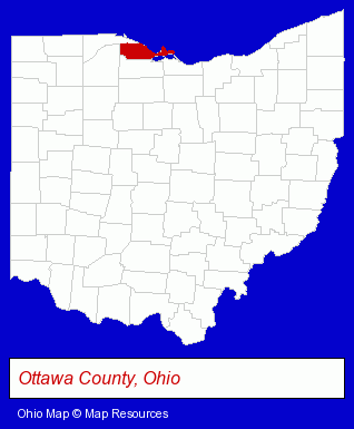
The Ohio counties map at upper right shows Ottawa County, highlighted in red. Use the menu below to display interactive maps of Port Clinton, either in a frame on this page or in full-screen mode.
Use the menu below to display categorized Port Clinton directories.
| Port Clinton Products and Services Directory | ||
|---|---|---|
| Home Improvement | Marinas | Sporting Goods Dealers |
Selected Port Clinton, Ohio Listings
These representative Port Clinton listings provide some insight into the city's cultural environment and economic climate.- Fishing Equipment & Supplies Dealers
- Fishing Bait & Tackle
- Fishing Guides & Charters
- Building & Home Construction
- Builders & Contractors
- Home Builders & Developers
- Construction Companies
- General Real Estate
- Insurance
- Health Insurance
- Lodging
- Hotels
- Motels
- Dentists
- Orthodontics Dentists
- Boat Dealers
- Restaurants
- Caterers
- Banquet Facilities
- Barbecue Restaurants
- Office Supplies Retail
- Stationery Retail
- Florists
- Floral & Balloon Arrangements
- Restaurants
- Steak Restaurants
- Attorneys
- Criminal Law Attorneys
- DUI and DWI Attorneys
- Traffic Law Attorneys
Nearby Ohio Cities and Towns *
- Bellevue (1) - Bellevue, Ohio information and maps.
- Fremont (2) - Fremont, Ohio information and maps.
- Huron (1) - Huron, Ohio information and maps.
- Perrysburg (2) - Perrysburg, Ohio information and maps.
- Toledo (35) - Toledo, Ohio products & services directory.
* Parenthesized numbers indicate economic activity levels.
Copyright © 2011-2026 RegionalDirectory.us. All rights reserved.