Springfield, Ohio Map and Directory
Regional Directory > States Menu > Ohio
 According to the United States Census Bureau, Springfield is a City that is located in Clark County, Ohio at 39.92 degrees North and 83.81 degrees West.
The city's time zone is America/New York, and the city's primary telephone area code is 937.
The land area of Springfield is about 25.55 square miles, whereas the water area of the city is about 0.20 square miles.
Clark County's land area is about 397 square miles, so the city occupies about 6.4 percent of the county's total land area.
According to the United States Census Bureau, Springfield is a City that is located in Clark County, Ohio at 39.92 degrees North and 83.81 degrees West.
The city's time zone is America/New York, and the city's primary telephone area code is 937.
The land area of Springfield is about 25.55 square miles, whereas the water area of the city is about 0.20 square miles.
Clark County's land area is about 397 square miles, so the city occupies about 6.4 percent of the county's total land area.
The Census Bureau estimates that Springfield had about 58,877 residents in 2019, which is approximately 2,304 people per square mile of land area.
According to recent American Community Survey data, the median household income in Springfield was about $39,332 per year.
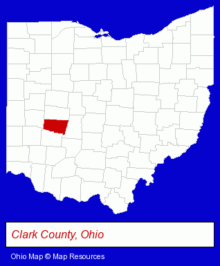
The Ohio counties map at upper right shows Clark County, highlighted in red. Use the menu below to display interactive maps of Springfield, either in a frame on this page or in full-screen mode.
Use the menu below to display categorized Springfield directories.
| Springfield Products and Services Directory | ||
|---|---|---|
| Auto Service | Building Materials | Business Services |
| Clothing Stores | Cremation Services | Home Improvement |
| Metals | Physicians | Schools |
| Steel Fabrication | Welding Contractors | Welding Services |
Selected Springfield, Ohio Listings
These randomly selected Springfield listings provide some insight into the city's cultural environment and economic climate.- Title Insurance
- Real Estate Title Search & Abstract Services
- Churches
- Schools
- Church & Religious Associations & Organizations
- Preschools & Kindergartens
- Presbyterian Churches
- Industrial Equipment & Supplies Wholesale & Manufacturers
- Industrial Equipment Parts & Accessories Wholesale & Manufacturers
- Medical Equipment & Supplies Retail
- Drug Stores & Pharmacies
- Hospital Equipment & Supplies Retail
- Pharmacists
- Moving & Storage
- Janitorial Equipment & Supplies Retail
- Dentists
- Cosmetic Dentists
- Pediatrics Physicians & Surgeons
- Business Consultants & Advisors
- Management Consultants
- Business Management Services
- Surgeons
- Podiatry Physicians & Surgeons
- Foot & Ankle Surgeons
- Auto Parts Wholesale & Manufacturers
- Truck Equipment, Parts & Accessories Retail
- Truck Parts & Equipment Wholesale & Manufacturers
- Industrial Equipment & Supplies Wholesale & Manufacturers
- Tool & Die Makers
- Machine Tools Wholesale & Manufacturing
- Metal Forming Machinery
Nearby Ohio Cities and Towns *
- Dayton (63) - Dayton, Ohio products & services directory.
- Piqua (3) - Piqua, Ohio information and maps.
- Sidney (2) - Sidney, Ohio information and maps.
* Parenthesized numbers indicate economic activity levels.
Copyright © 2011-2026 RegionalDirectory.us. All rights reserved.