Swanton, Ohio Map and Directory
Regional Directory > States Menu > Ohio
 According to the United States Census Bureau, Swanton is a Village that is located primarily in Fulton County, Ohio at 41.58 degrees North and 83.89 degrees West.
The village's time zone is America/New York, and the village's primary telephone area code is 419.
The land area of Swanton is about 3.17 square miles, whereas the water area of the village is about 0.04 square miles.
According to the United States Census Bureau, Swanton is a Village that is located primarily in Fulton County, Ohio at 41.58 degrees North and 83.89 degrees West.
The village's time zone is America/New York, and the village's primary telephone area code is 419.
The land area of Swanton is about 3.17 square miles, whereas the water area of the village is about 0.04 square miles.
The Census Bureau estimates that Swanton had about 3,894 residents in 2014, which is approximately 1,228 people per square mile of land area.
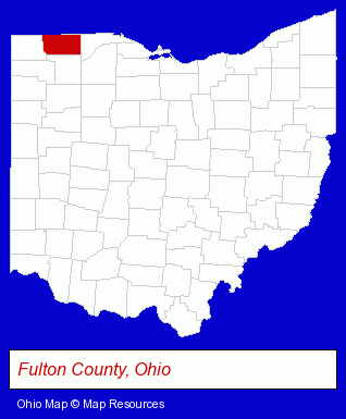
The Ohio counties map at upper right shows Fulton County, highlighted in red. Use the menu below to display interactive maps of Swanton, either in a frame on this page or in full-screen mode.
Use the menu below to display categorized Swanton directories.
| Swanton Directory Page: | Home Improvement |
|---|
Selected Swanton, Ohio Listings
These Swanton listings in zipcode 43558 provide a window into the village's cultural environment and economic climate. Air Illusions- Building & Home Construction
- Special Trades Contractors
- Painting Contractors
- Spray Painting & Finishing
- Truck Equipment, Parts & Accessories Retail
- Used & Rebuilt Auto Parts Retail
- Auto & Truck Wrecking
- Landscape Contractors
- Landscape Services
- Plastic & Plastic Products Wholesale & Manufacturers
- Polyurethane Products Manufacturers
- Building Materials & Supplies Dealers
- Fence Dealers
- Fence Materials
Nearby Ohio Cities and Towns *
- Holland (1) - Holland, Ohio information and maps.
- Maumee (2) - Maumee, Ohio information and maps.
- Perrysburg (2) - Perrysburg, Ohio information and maps.
- Sylvania (2) - Sylvania, Ohio information and maps.
- Toledo (35) - Toledo, Ohio products & services directory.
- Wauseon (1) - Wauseon, Ohio information and maps.
* Parenthesized numbers indicate economic activity levels.
Copyright © 2011-2026 RegionalDirectory.us. All rights reserved.