Muskogee, Oklahoma Map and Directory
Regional Directory > States Menu > Oklahoma
 According to the United States Census Bureau, Muskogee is a City that is located in Muskogee County, Oklahoma at 35.75 degrees North and 95.37 degrees West.
The city's time zone is America/Chicago, and the city's primary telephone area code is 918.
The land area of Muskogee is about 43.07 square miles, whereas the water area of the city is about 1.56 square miles.
Muskogee County's land area is about 810 square miles, so the city occupies about 5.3 percent of the county's total land area.
According to the United States Census Bureau, Muskogee is a City that is located in Muskogee County, Oklahoma at 35.75 degrees North and 95.37 degrees West.
The city's time zone is America/Chicago, and the city's primary telephone area code is 918.
The land area of Muskogee is about 43.07 square miles, whereas the water area of the city is about 1.56 square miles.
Muskogee County's land area is about 810 square miles, so the city occupies about 5.3 percent of the county's total land area.
The Census Bureau estimates that Muskogee had about 37,113 residents in 2019, which is approximately 862 people per square mile of land area.
According to recent American Community Survey data, the median household income in Muskogee was about $38,194 per year.
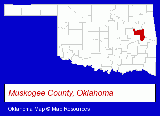
The Oklahoma counties map at upper right shows Muskogee County, highlighted in red. Use the menu below to display interactive maps of Muskogee, either in a frame on this page or in full-screen mode.
Use the menu below to display categorized Muskogee directories.
| Muskogee Products and Services Directory | ||
|---|---|---|
| Attorneys | Business Services | Clinics |
| Dentists | Home Improvement | Physicians |
Selected Muskogee, Oklahoma Listings
These randomly selected Muskogee listings provide some insight into the city's cultural environment and economic climate.- Insurance
- Auto Insurance
- Insurance Agents & Brokers
- Water Filtration Equipment Retail
- Clinics
- Pediatrics Dentists
- Dental Clinics
- Optometrists
- Optical Goods Retail
- General Practice
- Contact Lenses
- Employment Agencies
- Temporary Employment Agencies
- Employment Consultants
- Employment Training Services
- Employment Opportunities
- Grocery Stores & Supermarkets
- Food Products Wholesale & Manufacturers
- Coffee & Tea Shops
- Food Products Wholesale & Manufacturers
- Coffee Mills
- Veterinarians
- Animal Hospitals
- Animal Health
- Chiropractors
- Funeral Equipment & Supplies
- Ambulance Services
- Emergency Ambulance Services
- Optical Goods Retail
- Optical Goods Wholesalers & Manufacturers
- Auto Parts Wholesale & Manufacturers
- Used & Rebuilt Auto Parts Retail
- Used & Rebuilt Auto Parts Wholesale & Manufacturers
- Optical Goods Retail
- Contact Lenses
- Optical Goods Wholesalers & Manufacturers
- Tires Retail
- Wheel & Tire Service & Repair
Nearby Oklahoma Cities and Towns *
- Bixby (1) - Bixby, Oklahoma information and maps.
- Broken Arrow (18) - Broken Arrow, Oklahoma solutions directory and maps.
- Okmulgee (1) - Okmulgee, Oklahoma information and maps.
- Tahlequah (1) - Tahlequah, Oklahoma information and maps.
- Tulsa (129) - Tulsa, Oklahoma products & services directory.
* Parenthesized numbers indicate economic activity levels.
Copyright © 2011-2026 RegionalDirectory.us. All rights reserved.