Shawnee, Oklahoma Map and Directory
Regional Directory > States Menu > Oklahoma
 According to the United States Census Bureau, Shawnee is a City that is located in Pottawatomie County, Oklahoma at 35.33 degrees North and 96.93 degrees West.
The city's time zone is America/Chicago, and the city's primary telephone area code is 405.
The land area of Shawnee is about 44.14 square miles, whereas the water area of the city is about 2.31 square miles.
Pottawatomie County's land area is about 788 square miles, so the city occupies about 5.6 percent of the county's total land area.
According to the United States Census Bureau, Shawnee is a City that is located in Pottawatomie County, Oklahoma at 35.33 degrees North and 96.93 degrees West.
The city's time zone is America/Chicago, and the city's primary telephone area code is 405.
The land area of Shawnee is about 44.14 square miles, whereas the water area of the city is about 2.31 square miles.
Pottawatomie County's land area is about 788 square miles, so the city occupies about 5.6 percent of the county's total land area.
The Census Bureau estimates that Shawnee had about 31,436 residents in 2019, which is approximately 712 people per square mile of land area.
According to recent American Community Survey data, the median household income in Shawnee was about $40,473 per year.
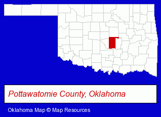
The Oklahoma counties map at upper right shows Pottawatomie County, highlighted in red. Use the menu below to display interactive maps of Shawnee, either in a frame on this page or in full-screen mode.
Use the menu below to display categorized Shawnee directories.
| Shawnee Products and Services Directory | ||
|---|---|---|
| Building Materials | Dentists | Home Improvement |
Selected Shawnee, Oklahoma Listings
These representative Shawnee listings provide some insight into the city's cultural environment and economic climate.- Sports & Recreation Facilities
- Health Clubs & Gyms
- Building & Home Construction
- Moving & Storage
- Industrial Equipment & Supplies Wholesale & Manufacturers
- Industrial Equipment Parts & Accessories Wholesale & Manufacturers
- Party Equipment & Supplies Sales & Rental
- Plastic & Plastic Products Wholesale & Manufacturers
- Plastic Molders
- Plastic Molds Manufacturers
- Disposable Products Retail
- Chiropractors
- Printing & Publishing
- Bookbinding
- Veterinarians
- Animal Hospitals
- Optometrists
- Contact Lenses
- Boat Dealers
- Towing
- Marine Equipment & Supplies Retail
- Boat Service & Repair
- Marine Equipment Service & Repair
- Medical Equipment & Supplies Retail
- Electric Contractors Residential
- Hospital Supplies
- Crane Rental & Leasing
- Lighting Fixtures Repair, Maintenance & Installation
- Grocery Stores & Supermarkets
- Exporters
- Orthodontics Dentists
- Restaurants
- Coffee & Tea Shops
- Physicians & Surgeons
- Alternative Medicine
- Chiropractors
- Alternative Medicine Practitioners
Nearby Oklahoma Cities and Towns *
- Ada (1) - Ada, Oklahoma information and maps.
- Drumright (1) - Drumright, Oklahoma information and maps.
- Edmond (32) - Edmond, Oklahoma solutions directory and maps.
- Moore (3) - Moore, Oklahoma information and maps.
- Norman (21) - Norman, Oklahoma solutions directory and maps.
- Oklahoma City (130) - Oklahoma City, Oklahoma products & services directory.
- Stillwater (13) - Stillwater, Oklahoma demographics and directory.
* Parenthesized numbers indicate economic activity levels.
Copyright © 2011-2026 RegionalDirectory.us. All rights reserved.