Yukon, Oklahoma Map and Directory
Regional Directory > States Menu > Oklahoma
 According to the United States Census Bureau, Yukon is a City that is located in Canadian County, Oklahoma at 35.51 degrees North and 97.76 degrees West.
The city's time zone is America/Chicago, and the city's primary telephone area code is 405.
The land area of Yukon is about 26.23 square miles, whereas the water area of the city is about 0.06 square miles.
Canadian County's land area is about 897 square miles, so the city occupies about 2.9 percent of the county's total land area.
According to the United States Census Bureau, Yukon is a City that is located in Canadian County, Oklahoma at 35.51 degrees North and 97.76 degrees West.
The city's time zone is America/Chicago, and the city's primary telephone area code is 405.
The land area of Yukon is about 26.23 square miles, whereas the water area of the city is about 0.06 square miles.
Canadian County's land area is about 897 square miles, so the city occupies about 2.9 percent of the county's total land area.
The Census Bureau estimates that Yukon had about 28,084 residents in 2019, which is approximately 1,071 people per square mile of land area.
According to recent American Community Survey data, the median household income in Yukon was about $66,419 per year.
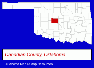
The Oklahoma counties map at upper right shows Canadian County, highlighted in red. Use the menu below to display interactive maps of Yukon, either in a frame on this page or in full-screen mode.
Use the menu below to display categorized Yukon directories.
| Yukon Products and Services Directory | ||
|---|---|---|
| Auto Service | Business Insurance | Dentists |
| Insurance | ||
Selected Yukon, Oklahoma Listings
These randomly selected Yukon listings provide some insight into the city's cultural environment and economic climate.- Auto Transmissions
- Legal Services
- Court Reporting
- Property & Casualty Insurance
- Business Insurance
- Boat & Yacht Insurance
- Motorcycle Insurance
- Furniture Stores
- Florists
- Building Materials & Supplies Dealers
- Building & Home Construction
- Builders & Contractors
- Foundation Contractors
- Optometrists
- Contact Lenses
- Mortgages
- Real Estate Loans
- Escrow Services
- Mortgage Brokers
- Restaurants
- Pizza Restaurants
- Churches
- Schools
- Preschools & Kindergartens
- Lutheran Churches
- Beauty Salons
- Barbers
- Manicures & Pedicures
- Importers
- Muffler & Exhaust System Service & Repair
- Drug Stores & Pharmacies
- Pharmacists
- Drugs & Medications
- Pharmacy & Pharmaceutical Consultants
Nearby Oklahoma Cities and Towns *
- Chickasha (1) - Chickasha, Oklahoma information and maps.
- Edmond (32) - Edmond, Oklahoma solutions directory and maps.
- El Reno (1) - El Reno, Oklahoma information and maps.
- Moore (3) - Moore, Oklahoma information and maps.
- Norman (21) - Norman, Oklahoma solutions directory and maps.
- Oklahoma City (130) - Oklahoma City, Oklahoma products & services directory.
- Stillwater (13) - Stillwater, Oklahoma demographics and directory.
* Parenthesized numbers indicate economic activity levels.
Copyright © 2011-2026 RegionalDirectory.us. All rights reserved.