The Dalles, Oregon Map and Directory
Regional Directory > States Menu > Oregon
 According to the United States Census Bureau, The Dalles is a City that is located in Wasco County, Oregon at 45.59 degrees North and 121.18 degrees West.
The city's time zone is America/Los Angeles, and the city's primary telephone area code is 541.
The land area of The Dalles is about 6.57 square miles, whereas the water area of the city is about 0.23 square miles.
Wasco County's land area is about 2,382 square miles, so the city occupies about 0.3 percent of the county's total land area.
According to the United States Census Bureau, The Dalles is a City that is located in Wasco County, Oregon at 45.59 degrees North and 121.18 degrees West.
The city's time zone is America/Los Angeles, and the city's primary telephone area code is 541.
The land area of The Dalles is about 6.57 square miles, whereas the water area of the city is about 0.23 square miles.
Wasco County's land area is about 2,382 square miles, so the city occupies about 0.3 percent of the county's total land area.
The Census Bureau estimates that The Dalles had about 15,761 residents in 2019, which is approximately 2,399 people per square mile of land area.
According to recent American Community Survey data, the median household income in The Dalles was about $50,678 per year.
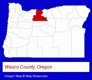
The Oregon counties map at upper right shows Wasco County, highlighted in red. Use the menu below to display interactive maps of The Dalles, either in a frame on this page or in full-screen mode.
Use the menu below to display categorized The Dalles directories.
| The Dalles Products and Services Directory | ||
|---|---|---|
| Auto Service | Electric Companies | Hotels |
| Restaurants | ||
Selected The Dalles, Oregon Listings
These randomly selected The Dalles listings provide some insight into the city's cultural environment and economic climate.- Auctions
- Auctioneers & Auction Houses
- Steak Restaurants
- Take Out
- Hotel & Motel Reservations
- Water & Sewage Companies
- Water Utility Companies
- Architects
- Architectural Designers
- Mortgages
- Real Estate Loans
- Escrow Services
- Auto Insurance
- Property & Casualty Insurance
- Life Insurance
- Business Insurance
- Fire Insurance
- Libraries
- Public Libraries
- Travel Agents
- Cruise Lines & Agents
- Airline Tickets
- Airlines
- Dentists
- Business Services
- Business Consultants & Advisors
- Economic Development Agencies
- Auto Parts Retail
- Auto Air Conditioning & Heating Service & Repair
- Auto Air Conditioning & Heating Retail
- Motorcycle, Motor Scooter & Minibike Dealers
- Bicycle Dealers
- Auto Cleaning & Detailing
- Motorcycle, Motor Scooter & ATV Service & Repair
- ATV Dealers
- Hotel & Motel Reservations
- Title Insurance
- Escrow Services
Nearby Oregon Cities and Towns *
- Gresham (8) - Gresham, Oregon demographics and maps.
- Hood River (10) - Hood River, Oregon demographics and directory.
- Lake Oswego (18) - Lake Oswego, Oregon solutions directory and maps.
- Oregon City (10) - Oregon City, Oregon demographics and directory.
- Portland (200) - Portland, Oregon products & services directory.
- Sandy (2) - Sandy, Oregon information and maps.
- West Linn (3) - West Linn, Oregon information and maps.
* Parenthesized numbers indicate economic activity levels.
Copyright © 2011-2026 RegionalDirectory.us. All rights reserved.