White City, Oregon Map and Directory
Regional Directory > States Menu > Oregon
 According to the United States Census Bureau, White City is a Census-designated Place that is located in Jackson County, Oregon at 42.44 degrees North and 122.86 degrees West.
The place's time zone is America/Los Angeles, and the place's primary telephone area code is 541.
The land area of White City is about 1.87 square miles, whereas the water area of the place is about 0.00 square miles.
Jackson County's land area is about 2,784 square miles, so the place occupies about 0.1 percent of the county's total land area.
According to the United States Census Bureau, White City is a Census-designated Place that is located in Jackson County, Oregon at 42.44 degrees North and 122.86 degrees West.
The place's time zone is America/Los Angeles, and the place's primary telephone area code is 541.
The land area of White City is about 1.87 square miles, whereas the water area of the place is about 0.00 square miles.
Jackson County's land area is about 2,784 square miles, so the place occupies about 0.1 percent of the county's total land area.
The Census Bureau estimates that White City had about 9,890 residents in 2019, which is approximately 5,289 people per square mile of land area.
According to recent American Community Survey data, the median household income in White City was about $44,724 per year.
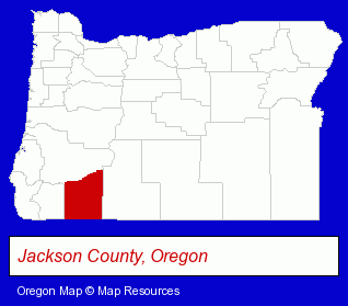
The Oregon counties map at upper right shows Jackson County, highlighted in red. Use the menu below to display interactive maps of White City, either in a frame on this page or in full-screen mode.
Use the menu below to display categorized White City directories.
| White City Products and Services Directory | ||
|---|---|---|
| Building Materials | Home Improvement | Ship Building |
Selected White City, Oregon Listings
These representative White City listings provide some insight into the place's cultural environment and economic climate.- Insulation Contractors
- Doors & Windows Installation
- Window Contractors
- Ship Building & Repair
- Government Contractors
- Consumer Electronics Stores
- Computer Printers
- Surgical Instruments Wholesale & Manufacturers
- Hospital Supplies
- Medical Equipment Service & Repair
- Restaurants
- Pizza Restaurants
- Building Materials & Supplies Wholesale & Manufacturers
- Importers
- Outdoor Sports & Recreation
- Hunting
- Ammunition Reloading Equipment & Supplies
- Sports & Recreation Facilities
- Health Clubs & Gyms
- Recreation Centers
- Fence Materials
- Fences Wholesale & Manufacturers
- Moving & Storage
- Trucking Companies
- Moving & Storage Commercial & Industrial
- Heavy Duty Trucking
- Heavy Equipment Movers
- Door & Window Dealers
- Garage Doors & Openers
- Government Contractors
- Ship Building & Repair
- Boat Builders & Wholesalers
- Ship Building & Repair
- Boat Builders & Wholesalers
- Building & Home Construction
- Builders & Contractors
- Construction Companies
- Printing & Publishing
- Publishers
- Magazine & Journal Publishers
- Building Materials & Supplies Wholesale & Manufacturers
- Building & Home Construction
- Building Materials & Supplies Dealers
- Builders & Contractors
- Building Materials & Supplies Wholesale & Manufacturers
Nearby Oregon Cities and Towns *
- Ashland (11) - Ashland, Oregon demographics and directory.
- Central Point (3) - Central Point, Oregon information and maps.
- Grants Pass (21) - Grants Pass, Oregon solutions directory and maps.
- Jacksonville (2) - Jacksonville, Oregon information and maps.
- Klamath Falls (7) - Klamath Falls, Oregon demographics and maps.
- Medford (32) - Medford, Oregon solutions directory and maps.
- Rogue River (1) - Rogue River, Oregon information and maps.
* Parenthesized numbers indicate economic activity levels.
Copyright © 2011-2026 RegionalDirectory.us. All rights reserved.