Erie, Pennsylvania Map and Directory
Regional Directory > States Menu > Pennsylvania
 According to the United States Census Bureau, Erie is a City that is located in Erie County, Pennsylvania at 42.13 degrees North and 80.09 degrees West.
The city's time zone is America/New York, and the city's primary telephone area code is 814.
The land area of Erie is about 19.13 square miles, whereas the water area of the city is about 0.16 square miles.
Erie County's land area is about 799 square miles, so the city occupies about 2.4 percent of the county's total land area.
According to the United States Census Bureau, Erie is a City that is located in Erie County, Pennsylvania at 42.13 degrees North and 80.09 degrees West.
The city's time zone is America/New York, and the city's primary telephone area code is 814.
The land area of Erie is about 19.13 square miles, whereas the water area of the city is about 0.16 square miles.
Erie County's land area is about 799 square miles, so the city occupies about 2.4 percent of the county's total land area.
The Census Bureau estimates that Erie had about 95,508 residents in 2019, which is approximately 4,993 people per square mile of land area.
According to recent American Community Survey data, the median household income in Erie was about $37,894 per year.
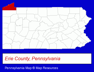
The Pennsylvania counties map at upper right shows Erie County, highlighted in red. Use the menu below to display interactive maps of Erie, either in a frame on this page or in full-screen mode.
Use the menu below to display categorized Erie directories.
Selected Erie, Pennsylvania Listings
These randomly selected Erie listings provide some insight into the city's cultural environment and economic climate.- Industrial Equipment & Supplies Wholesale & Manufacturers
- Industrial Equipment Parts & Accessories Wholesale & Manufacturers
- Plastic Molders
- Business Consultants & Advisors
- Advertising
- Advertising Agencies & Consultants
- Advertising & Design Agencies
- Metal Fabricators
- Sheet Metal Equipment & Supplies Wholesale & Manufacturers
- Auto Parts Retail
- Towing
- Business Consultants & Advisors
- Advertising
- Advertising Agencies & Consultants
- Advertising & Design Agencies
- Industrial Equipment & Supplies Wholesale & Manufacturers
- Tool & Die Makers
- Plastic Molders
- Credit Unions
- Floral & Balloon Arrangements
- Lodging
- Hotels
- Steak Restaurants
- Motels
- Corporate Business Attorneys
- Arbitration & Mediation Services
- Arbitration & Mediation Services Attorneys
- Appeals Attorneys
- Auto Alarms & Security Systems
- Car Audio & Video Retail
- Industrial Equipment & Supplies Dealers
- Metals
- Metal Finishing
- Candy & Confectionery Retail
- Photography
- Professional Photographers
- Portrait Photographers
- Photographers Commercial & Industrial
- Computer Consultants
Nearby Pennsylvania Cities and Towns *
- Corry (1) - Corry, Pennsylvania information and maps.
- Meadville (4) - Meadville, Pennsylvania information and maps.
* Parenthesized numbers indicate economic activity levels.
Copyright © 2011-2026 RegionalDirectory.us. All rights reserved.