Lansdale, Pennsylvania Map and Directory
Regional Directory > States Menu > Pennsylvania
 According to the United States Census Bureau, Lansdale is a Borough that is located in Montgomery County, Pennsylvania at 40.24 degrees North and 75.28 degrees West.
The borough's time zone is America/New York, and the borough's primary telephone area code is 445.
The land area of Lansdale is about 2.99 square miles, whereas the water area of the borough is about 0.00 square miles.
Montgomery County's land area is about 483 square miles, so the borough occupies about 0.6 percent of the county's total land area.
According to the United States Census Bureau, Lansdale is a Borough that is located in Montgomery County, Pennsylvania at 40.24 degrees North and 75.28 degrees West.
The borough's time zone is America/New York, and the borough's primary telephone area code is 445.
The land area of Lansdale is about 2.99 square miles, whereas the water area of the borough is about 0.00 square miles.
Montgomery County's land area is about 483 square miles, so the borough occupies about 0.6 percent of the county's total land area.
The Census Bureau estimates that Lansdale had about 17,083 residents in 2019, which is approximately 5,713 people per square mile of land area.
According to recent American Community Survey data, the median household income in Lansdale was about $66,794 per year.
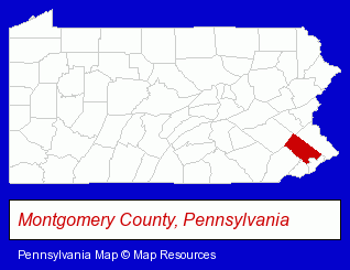
The Pennsylvania counties map at upper right shows Montgomery County, highlighted in red. Use the menu below to display interactive maps of Lansdale, either in a frame on this page or in full-screen mode.
Use the menu below to display categorized Lansdale directories.
| Lansdale Products and Services Directory | ||
|---|---|---|
| Building Materials | Home Improvement | Printing and Publishing |
| Visual Arts | ||
Selected Lansdale, Pennsylvania Listings
These randomly selected Lansdale listings provide some insight into the borough's cultural environment and economic climate.- Beauty Salons
- Hair Care & Treatment
- Barbers
- Manicures & Pedicures
- Beauticians
- Printing Services
- Publishers
- Newspaper Publishers
- Farms & Ranches
- Dairy Farms
- Speech & Hearing
- Hearing Aids & Assistive Devices Retail
- Speech & Hearing Equipment & Supplies Retail
- Chemicals Wholesale & Manufacturers
- Janitorial Equipment & Supplies Retail
- Building & Home Construction
- Special Trades Contractors
- Electric Contractors
- Electric Contractors Residential
- Elementary & Secondary Education
- Elementary Schools
Nearby Pennsylvania Cities and Towns *
- Blue Bell (5) - Blue Bell, Pennsylvania demographics and maps.
- Chalfont (1) - Chalfont, Pennsylvania information and maps.
- Hatfield (3) - Hatfield, Pennsylvania information and maps.
- Montgomeryville (2) - Montgomeryville, Pennsylvania information and maps.
- North Wales (2) - North Wales, Pennsylvania information and maps.
- Souderton (2) - Souderton, Pennsylvania information and maps.
- Telford (1) - Telford, Pennsylvania information and maps.
* Parenthesized numbers indicate economic activity levels.
Copyright © 2011-2026 RegionalDirectory.us. All rights reserved.