Paoli, Pennsylvania Map and Directory
Regional Directory > States Menu > Pennsylvania
 According to the United States Census Bureau, Paoli is a Census-designated Place that is located in Chester County, Pennsylvania at 40.04 degrees North and 75.48 degrees West.
The place's time zone is America/New York, and the place's primary telephone area code is 610.
The land area of Paoli is about 1.99 square miles, whereas the water area of the place is about 0.00 square miles.
Chester County's land area is about 751 square miles, so the place occupies about 0.3 percent of the county's total land area.
According to the United States Census Bureau, Paoli is a Census-designated Place that is located in Chester County, Pennsylvania at 40.04 degrees North and 75.48 degrees West.
The place's time zone is America/New York, and the place's primary telephone area code is 610.
The land area of Paoli is about 1.99 square miles, whereas the water area of the place is about 0.00 square miles.
Chester County's land area is about 751 square miles, so the place occupies about 0.3 percent of the county's total land area.
The Census Bureau estimates that Paoli had about 5,651 residents in 2019, which is approximately 2,840 people per square mile of land area.
According to recent American Community Survey data, the median household income in Paoli was about $73,050 per year.
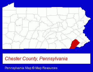
The Pennsylvania counties map at upper right shows Chester County, highlighted in red. Use the menu below to display interactive maps of Paoli, either in a frame on this page or in full-screen mode.
Use the menu below to display categorized Paoli directories.
| Paoli Products and Services Directory | ||
|---|---|---|
| Home Improvement | Insurance | Physicians |
Selected Paoli, Pennsylvania Listings
These representative Paoli listings provide some insight into the place's cultural environment and economic climate.- Engineers
- Consulting Engineers
- Landscape Architects
- Vocational Education
- Interior Decorators & Designers
- Wallpapers & Wallcoverings Equipment & Supplies Stores
- Wallpaper Removing Equipment Retail
- Building & Home Construction
- Architects
- Architectural Services
- Security Systems & Services
- Fire Departments
- Fire Department Equipment & Supplies
- Osteopathic Physicians & Surgeons
- Pediatrics Physicians & Surgeons
- Dermatology Physicians & Surgeons
- Cardiology Physicians & Surgeons
- Travel Agents
- Travel Industry
- Public Accountants
- Certified Public Accountants
- Business Services
- Insurance
- Business Consultants & Advisors
- Management Consultants
- Business Management Services
- Osteopathic Physicians & Surgeons
- Clothing Stores
- Sporting Goods Dealers
- Sportswear Retail
- Water Sports Equipment & Supplies Dealers
- Swimwear Retail
- Event Planning
- Party Planning
Nearby Pennsylvania Cities and Towns *
- Bryn Mawr (3) - Bryn Mawr, Pennsylvania information and maps.
- Exton (10) - Exton, Pennsylvania demographics and directory.
- King of Prussia (5) - King of Prussia, Pennsylvania demographics and maps.
- Malvern (7) - Malvern, Pennsylvania demographics and maps.
- Norristown (6) - Norristown, Pennsylvania demographics and maps.
- Phoenixville (4) - Phoenixville, Pennsylvania information and maps.
- West Chester (15) - West Chester, Pennsylvania demographics and directory.
* Parenthesized numbers indicate economic activity levels.
Copyright © 2011-2026 RegionalDirectory.us. All rights reserved.