Pawleys Island, South Carolina Map and Directory
Regional Directory > States Menu > South Carolina
 According to the United States Census Bureau, Pawleys Island is a Town that is located in Georgetown County, South Carolina at 33.43 degrees North and 79.12 degrees West.
The town's time zone is America/New York, and the town's primary telephone area code is 843.
The land area of Pawleys Island is about 0.70 square miles, whereas the water area of the town is about 0.29 square miles.
Georgetown County's land area is about 814 square miles, so the town occupies about 0.1 percent of the county's total land area.
According to the United States Census Bureau, Pawleys Island is a Town that is located in Georgetown County, South Carolina at 33.43 degrees North and 79.12 degrees West.
The town's time zone is America/New York, and the town's primary telephone area code is 843.
The land area of Pawleys Island is about 0.70 square miles, whereas the water area of the town is about 0.29 square miles.
Georgetown County's land area is about 814 square miles, so the town occupies about 0.1 percent of the county's total land area.
The Census Bureau estimates that Pawleys Island had about 105 residents in 2014, which is approximately 150 people per square mile of land area.
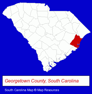
The South Carolina counties map at upper right shows Georgetown County, highlighted in red. Use the menu below to display interactive maps of Pawleys Island, either in a frame on this page or in full-screen mode.
Use the menu below to display categorized Pawleys Island directories.
| Pawleys Island Products and Services Directory | ||
|---|---|---|
| Dentists | Restaurants | Steak Restaurants |
Selected Pawleys Island, South Carolina Listings
These representative Pawleys Island listings provide some insight into the town's cultural environment and economic climate.- Fine Dining Restaurants
- Physicians & Surgeons
- Dentists
- Maxillofacial Physicians & Surgeons
- Bar & Grill Restaurants
- Breakfast & Brunch Restaurants
- Home Furnishings Stores
- Furniture Stores
- Office Supplies Retail
- Stationery Retail
- Outdoor Furniture Retail
- Moving & Storage
- Household Goods Moving & Storage
- Gift Shops
- Golf
- Golf Instruction
- Lodging
- Hotels
- Bed & Breakfasts
- Bed & Breakfast Reservations
- Physicians & Surgeons
- Dentists
- Cosmetic Dentists
- Maxillofacial Physicians & Surgeons
- Periodontics Dentists
Nearby South Carolina Cities and Towns *
- Charleston (31) - Charleston, South Carolina solutions directory and maps.
- Conway (2) - Conway, South Carolina information and maps.
- Florence (7) - Florence, South Carolina demographics and maps.
- Mount Pleasant (12) - Mount Pleasant, South Carolina demographics and directory.
- Murrells Inlet (2) - Murrells Inlet, South Carolina information and maps.
- Myrtle Beach (15) - Myrtle Beach, South Carolina demographics and directory.
- North Myrtle Beach (2) - North Myrtle Beach, South Carolina information and maps.
* Parenthesized numbers indicate economic activity levels.
Copyright © 2011-2026 RegionalDirectory.us. All rights reserved.