Seneca, South Carolina Map and Directory
Regional Directory > States Menu > South Carolina
 According to the United States Census Bureau, Seneca is a City that is located in Oconee County, South Carolina at 34.69 degrees North and 82.95 degrees West.
The city's time zone is America/New York, and the city's primary telephone area code is 864.
The land area of Seneca is about 7.86 square miles, whereas the water area of the city is about 0.05 square miles.
Oconee County's land area is about 626 square miles, so the city occupies about 1.3 percent of the county's total land area.
According to the United States Census Bureau, Seneca is a City that is located in Oconee County, South Carolina at 34.69 degrees North and 82.95 degrees West.
The city's time zone is America/New York, and the city's primary telephone area code is 864.
The land area of Seneca is about 7.86 square miles, whereas the water area of the city is about 0.05 square miles.
Oconee County's land area is about 626 square miles, so the city occupies about 1.3 percent of the county's total land area.
The Census Bureau estimates that Seneca had about 8,533 residents in 2019, which is approximately 1,086 people per square mile of land area.
According to recent American Community Survey data, the median household income in Seneca was about $41,017 per year.
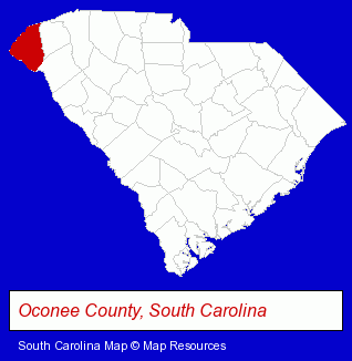
The South Carolina counties map at upper right shows Oconee County, highlighted in red. Use the menu below to display interactive maps of Seneca, either in a frame on this page or in full-screen mode.
Use the menu below to display categorized Seneca directories.
| Seneca Products and Services Directory | ||
|---|---|---|
| Home Improvement | Information Technology | Physicians |
| Schools | ||
Selected Seneca, South Carolina Listings
These randomly selected Seneca listings provide some insight into the city's cultural environment and economic climate. Carolina Dock- Docks
- Internet Products & Services
- Internet Services
- Internet Service Providers
- Preschools & Kindergartens
- Private Schools
- Religious Education Schools
- Christian Schools
- Osteopathic Physicians & Surgeons
- Pediatrics Physicians & Surgeons
- Advertising
- Signs Wholesale & Manufacturers
- Advertising & Promotional Product Dealers
- Computer Software
- Computer & Equipment Dealers
- Computer Consultants
Nearby South Carolina Cities and Towns *
- Anderson (8) - Anderson, South Carolina demographics and maps.
- Clemson (2) - Clemson, South Carolina information and maps.
- Easley (3) - Easley, South Carolina information and maps.
- Greenville (46) - Greenville, South Carolina products & services directory.
- Greer (6) - Greer, South Carolina demographics and maps.
- Piedmont (1) - Piedmont, South Carolina information and maps.
- Taylors (2) - Taylors, South Carolina information and maps.
* Parenthesized numbers indicate economic activity levels.
Copyright © 2011-2026 RegionalDirectory.us. All rights reserved.