West Columbia, South Carolina Map and Directory
Regional Directory > States Menu > South Carolina
 According to the United States Census Bureau, West Columbia is a City that is located in Lexington County, South Carolina at 33.99 degrees North and 81.07 degrees West.
The city's time zone is America/New York, and the city's primary telephone area code is 803.
The land area of West Columbia is about 7.20 square miles, whereas the water area of the city is about 0.21 square miles.
Lexington County's land area is about 699 square miles, so the city occupies about 1.0 percent of the county's total land area.
According to the United States Census Bureau, West Columbia is a City that is located in Lexington County, South Carolina at 33.99 degrees North and 81.07 degrees West.
The city's time zone is America/New York, and the city's primary telephone area code is 803.
The land area of West Columbia is about 7.20 square miles, whereas the water area of the city is about 0.21 square miles.
Lexington County's land area is about 699 square miles, so the city occupies about 1.0 percent of the county's total land area.
The Census Bureau estimates that West Columbia had about 17,998 residents in 2019, which is approximately 2,500 people per square mile of land area.
According to recent American Community Survey data, the median household income in West Columbia was about $46,623 per year.
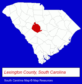
The South Carolina counties map at upper right shows Lexington County, highlighted in red. Use the menu below to display interactive maps of West Columbia, either in a frame on this page or in full-screen mode.
Use the menu below to display categorized West Columbia directories.
| West Columbia Products and Services Directory | ||
|---|---|---|
| Clinics | Home Furnishings | Home Improvement |
| Metals | Physicians | Printing and Publishing |
| Restaurants | Schools | |
Selected West Columbia, South Carolina Listings
These randomly selected West Columbia listings provide some insight into the city's cultural environment and economic climate.- Printing Services
- Commercial Printing
- Office Supplies Retail
- Business Forms & Systems
- Auto Parts Retail
- Auto Accessories Retail
- Steak Restaurants
- Public Golf Courses
- Private Golf Courses
- Housewares Stores
- Fabric Shops
- Textiles Retail
- Sewing Machine Dealers
- Florists
- Nurseries
- Plants Retail
- Plants & Trees Retail Nurseries
- Retail Nurseries
- Furniture Stores
- Outdoor Furniture Retail
- Business Services
- Business Consultants & Advisors
- Advertising Agencies & Consultants
- Real Estate Schools
- Rental Stores & Yards
- Janitorial Equipment & Supplies Retail
- Carpet Cleaning Products Wholesale & Manufacturers
- Building & Home Construction
- Builders & Contractors
- Foundation Contractors
Nearby South Carolina Cities and Towns *
- Aiken (3) - Aiken, South Carolina information and maps.
- Camden (1) - Camden, South Carolina information and maps.
- Columbia (40) - Columbia, South Carolina products & services directory.
- Irmo (1) - Irmo, South Carolina information and maps.
- Lexington (9) - Lexington, South Carolina demographics and directory.
- Newberry (2) - Newberry, South Carolina information and maps.
- Sumter (4) - Sumter, South Carolina information and maps.
* Parenthesized numbers indicate economic activity levels.
Copyright © 2011-2026 RegionalDirectory.us. All rights reserved.