Brownsville, Texas Map and Directory
Regional Directory > States Menu > Texas
 According to the United States Census Bureau, Brownsville is a City that is located in Cameron County, Texas at 25.90 degrees North and 97.50 degrees West.
The city's time zone is America/Chicago, and the city's primary telephone area code is 956.
The land area of Brownsville is about 132.45 square miles, whereas the water area of the city is about 13.83 square miles.
Cameron County's land area is about 891 square miles, so the city occupies about 14.9 percent of the county's total land area.
According to the United States Census Bureau, Brownsville is a City that is located in Cameron County, Texas at 25.90 degrees North and 97.50 degrees West.
The city's time zone is America/Chicago, and the city's primary telephone area code is 956.
The land area of Brownsville is about 132.45 square miles, whereas the water area of the city is about 13.83 square miles.
Cameron County's land area is about 891 square miles, so the city occupies about 14.9 percent of the county's total land area.
The Census Bureau estimates that Brownsville had about 182,781 residents in 2019, which is approximately 1,380 people per square mile of land area.
According to recent American Community Survey data, the median household income in Brownsville was about $38,588 per year.
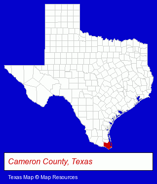
The Texas counties map at upper right shows Cameron County, highlighted in red. Use the menu below to display interactive maps of Brownsville, either in a frame on this page or in full-screen mode.
Use the menu below to display categorized Brownsville directories.
| Brownsville Products and Services Directory | ||
|---|---|---|
| Attorneys | Business Education | Business Services |
| Clinics | Physicians | Schools |
| Vocational Education | ||
Selected Brownsville, Texas Listings
These randomly selected Brownsville listings provide some insight into the city's cultural environment and economic climate.- Accountants
- Accounting, Auditing & Bookkeeping Services
- Clothing Stores
- T-Shirts Retail
- Roofing Contractors
- Gutters & Downspouts Dealers
- Truck Dealers
- Used Cars
- Towing
- Metals
- Metal Fabricators
- Sheet Metal Equipment & Supplies Wholesale & Manufacturers
- Door & Door Frame Dealers
- Dermatology Physicians & Surgeons
- Skin Care Products
- Hair Removal
- Laser Hair Removal
- Colleges & Universities
- Private Schools
- Religious Education Schools
- Diamonds Retail
- Watches Retail
- Roofing Contractors
- Neurology Physicians & Surgeons
- Otolaryngology Physicians & Surgeons
Nearby Texas Cities and Towns *
- Corpus Christi (54) - Corpus Christi, Texas products & services directory.
- Edinburg (2) - Edinburg, Texas information and maps.
- Harlingen (4) - Harlingen, Texas information and maps.
- McAllen (15) - McAllen, Texas demographics and directory.
- Mission (1) - Mission, Texas information and maps.
- South Padre Island (1) - South Padre Island, Texas information and maps.
- Weslaco (1) - Weslaco, Texas information and maps.
* Parenthesized numbers indicate economic activity levels.
Copyright © 2011-2026 RegionalDirectory.us. All rights reserved.