El Paso, Texas Map and Directory
Regional Directory > States Menu > Texas
 According to the United States Census Bureau, El Paso is a City that is located in El Paso County, Texas at 31.76 degrees North and 106.49 degrees West.
The city's time zone is America/Denver, and the city's primary telephone area code is 915.
The land area of El Paso is about 256.75 square miles, whereas the water area of the city is about 0.87 square miles.
El Paso County's land area is about 1,013 square miles, so the city occupies about 25.3 percent of the county's total land area.
According to the United States Census Bureau, El Paso is a City that is located in El Paso County, Texas at 31.76 degrees North and 106.49 degrees West.
The city's time zone is America/Denver, and the city's primary telephone area code is 915.
The land area of El Paso is about 256.75 square miles, whereas the water area of the city is about 0.87 square miles.
El Paso County's land area is about 1,013 square miles, so the city occupies about 25.3 percent of the county's total land area.
The Census Bureau estimates that El Paso had about 681,728 residents in 2019, which is approximately 2,655 people per square mile of land area.
According to recent American Community Survey data, the median household income in El Paso was about $47,568 per year. This El Paso Real Estate directory lists real estate solution providers in El Paso, Texas.
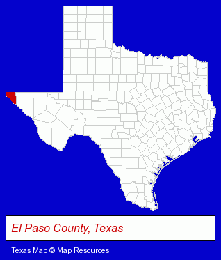
The Texas counties map at upper right shows El Paso County, highlighted in red. Use the menu below to display interactive maps of El Paso, either in a frame on this page or in full-screen mode.
Use the menu below to display categorized El Paso directories.
Selected El Paso, Texas Listings
These randomly selected El Paso listings provide some insight into the city's cultural environment and economic climate.- Water Sports
- Scuba & Skin Diving
- Diving Instruction
- Diving Equipment & Supplies
- Auto Equipment & Supplies Retail
- Auto Paint
- Consumer Electronics Stores
- Computer Hardware & Supplies
- Cameras & Camera Supplies
- Electronics
- Digital Cameras
- Swimming Pool & Spa Construction & Contractors
- Bar & Grill Restaurants
- Family Restaurants
- Southwestern Restaurants
- Industrial Equipment & Supplies Dealers
- Industrial Equipment & Supplies Wholesale & Manufacturers
- Toy Stores
- Clothing Wholesale & Manufacturers
- Leather Clothing Wholesale & Manufacturers
- Metal Products
- Metal Products Wholesale & Manufacturers
- Computer Consultants
- Computer Networks
- Web Site Design
- Web Site Developers
- Internet Marketing Services
- Packaging & Shipping Materials Retail
- Packing & Crating Materials
- CDs & Audiotapes Wholesale & Manufacturers
- Private Golf Courses
- Private Golf Clubs
- Consumer Electronics Stores
- Electric Equipment & Supplies Dealers
- Electronic Equipment & Supplies Wholesale & Manufacturers
- Electronic Equipment & Supplies Retail
- Electronic Equipment & Supplies Service & Repair
Nearby Texas Cities and Towns *
- Midland (15) - Midland, Texas demographics and directory.
- Odessa (14) - Odessa, Texas demographics and directory.
Large and Mid-size Cities in Nearby States
- Las Cruces, New Mexico (12) - Las Cruces, NM demographics and maps.
* Parenthesized numbers indicate economic activity levels.
Copyright © 2011-2026 RegionalDirectory.us. All rights reserved.