The Colony, Texas Map and Directory
Regional Directory > States Menu > Texas
 According to the United States Census Bureau, The Colony is a City that is located in Denton County, Texas at 33.09 degrees North and 96.89 degrees West.
The city's time zone is America/Chicago, and the city's primary telephone area code is 972.
The land area of The Colony is about 13.98 square miles, whereas the water area of the city is about 2.07 square miles.
Denton County's land area is about 878 square miles, so the city occupies about 1.6 percent of the county's total land area.
According to the United States Census Bureau, The Colony is a City that is located in Denton County, Texas at 33.09 degrees North and 96.89 degrees West.
The city's time zone is America/Chicago, and the city's primary telephone area code is 972.
The land area of The Colony is about 13.98 square miles, whereas the water area of the city is about 2.07 square miles.
Denton County's land area is about 878 square miles, so the city occupies about 1.6 percent of the county's total land area.
The Census Bureau estimates that The Colony had about 44,438 residents in 2019, which is approximately 3,179 people per square mile of land area.
According to recent American Community Survey data, the median household income in The Colony was about $87,187 per year.
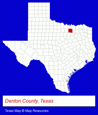
The Texas counties map at upper right shows Denton County, highlighted in red. Use the menu below to display interactive maps of The Colony, either in a frame on this page or in full-screen mode.
Use the menu below to display categorized The Colony directories.
| The Colony Products and Services Directory | ||
|---|---|---|
| Animal Hospitals | Plumbing Contractors | Recreation Centers |
Selected The Colony, Texas Listings
These representative The Colony listings provide some insight into the city's cultural environment and economic climate.- Veterinarians
- Heating Contractors
- Heating & Air Conditioning Contractors
- Dentists
- Plumbing Service & Repair
- Licensed Plumbing Contractors
- Plumbing Contractors Commercial & Industrial
- Leak Detection Services
- Carpet & Rug Dealers
- Ceramic Tile Contractors
- Ceramic Tile Contractors Commercial & Industrial
- Cell Phone Services
- Landscape Contractors
- Government Contractors
- Landscape Services
- Tax Return Preparation
- Tax Return Preparation & Electronic Filing
- Notaries Public
- Income Tax Services
- Tax Reporting Services
- Information Technology Services
- Internet Products & Services
- Web Site Design
- Web Sites
- Veterinarians
- Animal Hospitals
- Telecommunications Services
- Coffee & Tea Shops
- Bar & Grill Restaurants
- Family Restaurants
- Southwestern Restaurants
- Sports & Recreation Facilities
- Recreation Centers
- Clinics & Medical Centers
- Veterinarians
- Animal Hospitals
- Animal Health
- Pet Food & Supplies Retail
- Sports & Recreation Facilities
- Recreation Centers
Nearby Texas Cities and Towns *
- Addison (8) - Addison, Texas demographics and maps.
- Allen (12) - Allen, Texas demographics and directory.
- Carrollton (22) - Carrollton, Texas solutions directory and maps.
- Coppell (3) - Coppell, Texas information and maps.
- Frisco (21) - Frisco, Texas solutions directory and maps.
- Lewisville (12) - Lewisville, Texas demographics and directory.
- Plano (55) - Plano, Texas products & services directory.
* Parenthesized numbers indicate economic activity levels.
Copyright © 2011-2026 RegionalDirectory.us. All rights reserved.