Staunton, Virginia Map and Directory
Regional Directory > States Menu > Virginia
 According to the United States Census Bureau, Staunton is a City that is located in Staunton City County, Virginia at 38.15 degrees North and 79.07 degrees West.
The city's time zone is America/New York, and the city's primary telephone area code is 540.
The land area of Staunton is about 19.96 square miles, whereas the water area of the city is about 0.06 square miles.
Staunton City County's land area is about 20 square miles, so the city occupies about 99.8 percent of the county's total land area.
According to the United States Census Bureau, Staunton is a City that is located in Staunton City County, Virginia at 38.15 degrees North and 79.07 degrees West.
The city's time zone is America/New York, and the city's primary telephone area code is 540.
The land area of Staunton is about 19.96 square miles, whereas the water area of the city is about 0.06 square miles.
Staunton City County's land area is about 20 square miles, so the city occupies about 99.8 percent of the county's total land area.
The Census Bureau estimates that Staunton had about 24,932 residents in 2019, which is approximately 1,249 people per square mile of land area.
According to recent American Community Survey data, the median household income in Staunton was about $52,611 per year.
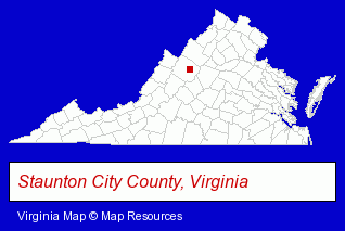
The Virginia counties map at upper right shows Staunton City County, highlighted in red. Use the menu below to display interactive maps of Staunton, either in a frame on this page or in full-screen mode.
Use the menu below to display categorized Staunton directories.
| Staunton Products and Services Directory | ||
|---|---|---|
| Building Materials | Home Improvement | Restaurants |
| Steak Restaurants | Visual Arts | |
Selected Staunton, Virginia Listings
These randomly selected Staunton listings provide some insight into the city's cultural environment and economic climate.- Floors & Flooring Contractors
- Floors & Flooring Installation
- Floors & Flooring Retail
- Floor Resurfacing Materials
- Other Schools & Instruction
- Arts Organizations & Information
- Art Schools
- Art Galleries & Dealers
- Lodging
- Hotels
- Bed & Breakfasts
- Bed & Breakfast Reservations
- Musical Instruments Retail
- Bar & Grill Restaurants
- Quilting Materials & Supplies Retail
- Agricultural Equipment & Supplies Retail
- Farm Equipment & Supplies Dealers
- Lawn & Garden Outdoor Power Equipment
- Lawn Mowers Retail
- Tractor Equipment & Parts Dealers
Nearby Virginia Cities and Towns *
- Charlottesville (28) - Charlottesville, Virginia solutions directory and maps.
- Harrisonburg (12) - Harrisonburg, Virginia demographics and directory.
- Lynchburg (11) - Lynchburg, Virginia demographics and directory.
- Roanoke (27) - Roanoke, Virginia solutions directory and maps.
- Waynesboro (2) - Waynesboro, Virginia information and maps.
- Winchester (8) - Winchester, Virginia demographics and maps.
* Parenthesized numbers indicate economic activity levels.
Copyright © 2011-2026 RegionalDirectory.us. All rights reserved.