Warrenton, Virginia Map and Directory
Regional Directory > States Menu > Virginia
 According to the United States Census Bureau, Warrenton is a Town that is located in Fauquier County, Virginia at 38.71 degrees North and 77.80 degrees West.
The town's time zone is America/New York, and the town's primary telephone area code is 540.
The land area of Warrenton is about 4.50 square miles, whereas the water area of the town is about 0.01 square miles.
Fauquier County's land area is about 647 square miles, so the town occupies about 0.7 percent of the county's total land area.
According to the United States Census Bureau, Warrenton is a Town that is located in Fauquier County, Virginia at 38.71 degrees North and 77.80 degrees West.
The town's time zone is America/New York, and the town's primary telephone area code is 540.
The land area of Warrenton is about 4.50 square miles, whereas the water area of the town is about 0.01 square miles.
Fauquier County's land area is about 647 square miles, so the town occupies about 0.7 percent of the county's total land area.
The Census Bureau estimates that Warrenton had about 10,027 residents in 2019, which is approximately 2,228 people per square mile of land area.
According to recent American Community Survey data, the median household income in Warrenton was about $73,402 per year.
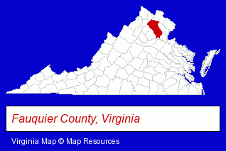
The Virginia counties map at upper right shows Fauquier County, highlighted in red. Use the menu below to display interactive maps of Warrenton, either in a frame on this page or in full-screen mode.
Use the menu below to display categorized Warrenton directories.
| Warrenton Products and Services Directory | ||
|---|---|---|
| Auto Service | Home Improvement | Physicians |
| Restaurants | ||
Selected Warrenton, Virginia Listings
These randomly selected Warrenton listings provide some insight into the town's cultural environment and economic climate.- Landscape Contractors
- Building Materials & Supplies Dealers
- Door & Window Dealers
- Garage Doors & Openers
- Garage Door Repair
- Utilities
- Water & Sewage Companies
- Water Utility Companies
- Steak Restaurants
- Pizza Restaurants
- Embroidery & Needlework
- Embroidery Service
- Clinics & Medical Centers
- Veterinarians
- Animal Hospitals
- Animal Health
- Pet Care Services
- Pet Grooming & Boarding
- Pet Grooming
- Pizza Restaurants
- Fast Food Restaurants
- Sandwich Shops
- Truck Dealers
- Used Cars
- Used Trucks
- Auto Body Repair & Painting
- Pediatrics Physicians & Surgeons
- Personal Injury Attorneys
- Criminal Law Attorneys
- Family Law Attorneys
- DUI and DWI Attorneys
Nearby Virginia Cities and Towns *
- Centreville (2) - Centreville, Virginia information and maps.
- Chantilly (12) - Chantilly, Virginia demographics and directory.
- Gainesville (1) - Gainesville, Virginia information and maps.
- Herndon (11) - Herndon, Virginia demographics and directory.
- Manassas (14) - Manassas, Virginia demographics and directory.
- Middleburg (1) - Middleburg, Virginia information and maps.
- Midland (2) - Midland, Virginia information and maps.
* Parenthesized numbers indicate economic activity levels.
Copyright © 2011-2026 RegionalDirectory.us. All rights reserved.