Edmonds, Washington Map and Directory
Regional Directory > States Menu > Washington
 According to the United States Census Bureau, Edmonds is a City that is located in Snohomish County, Washington at 47.81 degrees North and 122.38 degrees West.
The city's time zone is America/Los Angeles, and the city's primary telephone area code is 425.
The land area of Edmonds is about 8.90 square miles, whereas the water area of the city is about 9.52 square miles.
Snohomish County's land area is about 2,087 square miles, so the city occupies about 0.4 percent of the county's total land area.
According to the United States Census Bureau, Edmonds is a City that is located in Snohomish County, Washington at 47.81 degrees North and 122.38 degrees West.
The city's time zone is America/Los Angeles, and the city's primary telephone area code is 425.
The land area of Edmonds is about 8.90 square miles, whereas the water area of the city is about 9.52 square miles.
Snohomish County's land area is about 2,087 square miles, so the city occupies about 0.4 percent of the county's total land area.
The Census Bureau estimates that Edmonds had about 42,605 residents in 2019, which is approximately 4,787 people per square mile of land area.
According to recent American Community Survey data, the median household income in Edmonds was about $89,229 per year.
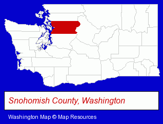
The Washington counties map at upper right shows Snohomish County, highlighted in red. Use the menu below to display interactive maps of Edmonds, either in a frame on this page or in full-screen mode.
Use the menu below to display categorized Edmonds directories.
| Edmonds Products and Services Directory | ||
|---|---|---|
| Accountants | Attorneys | Building Materials |
| Clinics | Dentists | Home Improvement |
| Insurance | Physicians | Restaurants |
| Visual Arts | ||
Selected Edmonds, Washington Listings
These randomly selected Edmonds listings provide some insight into the city's cultural environment and economic climate.- Cosmetic Dentists
- Prosthodontics Dentists
- Steak Restaurants
- Clothing & Accessories Retail
- Jewelers
- Jewelry Repair
- Watch Service & Repair
- Cosmetic Dentists
- Bakeries
- Financial Services
- Financial Planning Consultants & Services
- Fine Dining Restaurants
- Lodging
- Hotels
- Motels
- Hotel & Motel Management
- Florists
- Nurseries
- Flower Wholesalers
- Landscape Contractors
- Landscape Services
- Landscape Designers & Consultants
- Property Management
- Radio Sales & Service
- Two-Way Radio Sales & Service
- Landscape Contractors
- Landscape Services
- Landscape Designers & Consultants
- Landscape Gardeners
- Building & Home Construction
- Architects
- Architectural Services
Nearby Washington Cities and Towns *
- Bothell (6) - Bothell, Washington demographics and maps.
- Kenmore (2) - Kenmore, Washington information and maps.
- Kingston (1) - Kingston, Washington information and maps.
- Kirkland (17) - Kirkland, Washington solutions directory and maps.
- Lynnwood (10) - Lynnwood, Washington demographics and directory.
- Mukilteo (2) - Mukilteo, Washington information and maps.
- Woodinville (11) - Woodinville, Washington demographics and directory.
* Parenthesized numbers indicate economic activity levels.
Copyright © 2011-2026 RegionalDirectory.us. All rights reserved.