Kent, Washington Map and Directory
Regional Directory > States Menu > Washington
 According to the United States Census Bureau, Kent is a City that is located in King County, Washington at 47.38 degrees North and 122.23 degrees West.
The city's time zone is America/Los Angeles, and the city's primary telephone area code is 253.
The land area of Kent is about 33.74 square miles, whereas the water area of the city is about 0.67 square miles.
King County's land area is about 2,116 square miles, so the city occupies about 1.6 percent of the county's total land area.
According to the United States Census Bureau, Kent is a City that is located in King County, Washington at 47.38 degrees North and 122.23 degrees West.
The city's time zone is America/Los Angeles, and the city's primary telephone area code is 253.
The land area of Kent is about 33.74 square miles, whereas the water area of the city is about 0.67 square miles.
King County's land area is about 2,116 square miles, so the city occupies about 1.6 percent of the county's total land area.
The Census Bureau estimates that Kent had about 132,319 residents in 2019, which is approximately 3,922 people per square mile of land area.
According to recent American Community Survey data, the median household income in Kent was about $72,062 per year.
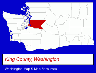
The Washington counties map at upper right shows King County, highlighted in red. Use the menu below to display interactive maps of Kent, either in a frame on this page or in full-screen mode.
Use the menu below to display categorized Kent directories.
| Kent Products and Services Directory | ||
|---|---|---|
| Attorneys | Building Materials | Chiropractors |
| Cleaning Services | Dentists | Home Improvement |
| Information Technology | Metals | Movers |
| Moving and Storage | Printing and Publishing | |
Selected Kent, Washington Listings
These randomly selected Kent listings provide some insight into the city's cultural environment and economic climate.- Auto Body Repair & Painting
- Medical Equipment & Supplies Retail
- Hospital Equipment & Supplies Retail
- Medical Equipment & Supplies Wholesale & Manufacturers
- Surgical Instruments Wholesale & Manufacturers
- Utilities
- Water & Sewage Companies
- Water Utility Companies
- Packaging & Shipping Materials Retail
- Chemicals Dealers
- Libraries
- Funeral Services
- Funeral Homes & Directors
- Cremation Services
- Pre-Arranged Funeral Plans
- Podiatry Physicians & Surgeons
- Sewer & Drain Cleaning, Service & Repair
- Alternative Medicine
- Chiropractors
- Alternative Medicine Practitioners
- Certified & Registered Massage Therapists
- Business Management Services
- Housewares Wholesale & Manufacturers
- Research Consultants
- Exterior Cleaning Services
- Sandblasting
- Gift Shops
- Hobbies
- Hobby & Model Stores
- Electric Contractors Residential
Nearby Washington Cities and Towns *
- Auburn (13) - Auburn, Washington demographics and directory.
- Federal Way (4) - Federal Way, Washington information and maps.
- Issaquah (6) - Issaquah, Washington demographics and maps.
- Mercer Island (5) - Mercer Island, Washington demographics and maps.
- Puyallup (14) - Puyallup, Washington demographics and directory.
- Renton (12) - Renton, Washington demographics and directory.
- Tacoma (39) - Tacoma, Washington products & services directory.
* Parenthesized numbers indicate economic activity levels.
Copyright © 2011-2026 RegionalDirectory.us. All rights reserved.