Port Orchard, Washington Map and Directory
Regional Directory > States Menu > Washington
 According to the United States Census Bureau, Port Orchard is a City that is located in Kitsap County, Washington at 47.54 degrees North and 122.64 degrees West.
The city's time zone is America/Los Angeles, and the city's primary telephone area code is 360.
The land area of Port Orchard is about 9.68 square miles, whereas the water area of the city is about 1.45 square miles.
Kitsap County's land area is about 395 square miles, so the city occupies about 2.5 percent of the county's total land area.
According to the United States Census Bureau, Port Orchard is a City that is located in Kitsap County, Washington at 47.54 degrees North and 122.64 degrees West.
The city's time zone is America/Los Angeles, and the city's primary telephone area code is 360.
The land area of Port Orchard is about 9.68 square miles, whereas the water area of the city is about 1.45 square miles.
Kitsap County's land area is about 395 square miles, so the city occupies about 2.5 percent of the county's total land area.
The Census Bureau estimates that Port Orchard had about 14,597 residents in 2019, which is approximately 1,508 people per square mile of land area.
According to recent American Community Survey data, the median household income in Port Orchard was about $69,962 per year.
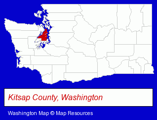
The Washington counties map at upper right shows Kitsap County, highlighted in red. Use the menu below to display interactive maps of Port Orchard, either in a frame on this page or in full-screen mode.
Use the menu below to display categorized Port Orchard directories.
| Port Orchard Products and Services Directory | ||
|---|---|---|
| Attorneys | Clinics | Restaurants |
Selected Port Orchard, Washington Listings
These representative Port Orchard listings provide some insight into the city's cultural environment and economic climate.- Take Out
- Delicatessens
- Financial Services
- Accountants
- Public Accountants
- Accounting, Auditing & Bookkeeping Services
- Certified Public Accountants
- Industrial Equipment Rebuilding, Service & Repair
- Brake Service & Repair
- Steak Restaurants
- Public Golf Courses
- Radio Stations
- Radio Stations
- Outdoor Sports & Recreation
- Lodging
- Campgrounds & RV Parks
- Camps
- Sports Camps
- Building & Home Construction
- Builders & Contractors
- Financial Services
- Investment Services
- Investment Advisory Services
- Physicians & Surgeons
- Clinics & Medical Centers
- Alternative Medicine
- Alternative Medicine Practitioners
- Clinics
- Corporate Business Attorneys
- Estate Planning & Administration Attorneys
- Real Estate Attorneys
- Banking & Investment Law Attorneys
- Marine Equipment & Supplies Retail
- Alternative Medicine
- Chiropractors
- Alternative Medicine Practitioners
- Sports & Recreation Facilities
- Health Clubs & Gyms
- Tanning Salons
Nearby Washington Cities and Towns *
- Bainbridge Island (10) - Bainbridge Island, Washington demographics and directory.
- Bremerton (5) - Bremerton, Washington demographics and maps.
- Gig Harbor (4) - Gig Harbor, Washington information and maps.
- Poulsbo (7) - Poulsbo, Washington demographics and maps.
- Seattle (161) - Seattle, Washington products & services directory.
- Silverdale (1) - Silverdale, Washington information and maps.
- Vashon (1) - Vashon, Washington information and maps.
* Parenthesized numbers indicate economic activity levels.
Copyright © 2011-2026 RegionalDirectory.us. All rights reserved.