Walla Walla, Washington Map and Directory
Regional Directory > States Menu > Washington
 According to the United States Census Bureau, Walla Walla is a City that is located in Walla Walla County, Washington at 46.06 degrees North and 118.34 degrees West.
The city's time zone is America/Los Angeles, and the city's primary telephone area code is 509.
The land area of Walla Walla is about 12.80 square miles, whereas the water area of the city is about 0.03 square miles.
Walla Walla County's land area is about 1,270 square miles, so the city occupies about 1.0 percent of the county's total land area.
According to the United States Census Bureau, Walla Walla is a City that is located in Walla Walla County, Washington at 46.06 degrees North and 118.34 degrees West.
The city's time zone is America/Los Angeles, and the city's primary telephone area code is 509.
The land area of Walla Walla is about 12.80 square miles, whereas the water area of the city is about 0.03 square miles.
Walla Walla County's land area is about 1,270 square miles, so the city occupies about 1.0 percent of the county's total land area.
The Census Bureau estimates that Walla Walla had about 32,900 residents in 2019, which is approximately 2,570 people per square mile of land area.
According to recent American Community Survey data, the median household income in Walla Walla was about $50,550 per year.
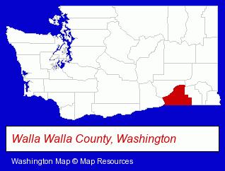
The Washington counties map at upper right shows Walla Walla County, highlighted in red. Use the menu below to display interactive maps of Walla Walla, either in a frame on this page or in full-screen mode.
Use the menu below to display categorized Walla Walla directories.
| Walla Walla Products and Services Directory | ||
|---|---|---|
| Building Materials | Cleaning Services | Clinics |
| Financial Services | Home Improvement | Information Technology |
| Insurance | Sporting Goods Dealers | |
Selected Walla Walla, Washington Listings
These randomly selected Walla Walla listings provide some insight into the city's cultural environment and economic climate.- Outdoor Sports & Recreation
- Clothing & Accessories Retail
- Optical Goods Retail
- Bicycle Dealers
- Eyeglasses, Sunglasses & Goggles Retail
- Lodging
- Hotels
- Motels
- Hotel & Motel Reservations
- Utilities
- Electric Companies
- Cosmetics Retail
- Perfumes & Colognes Retail
- Agricultural Equipment & Supplies Retail
- Farm Equipment & Supplies Dealers
- Pet Care Services
- Animal Shelters
- Pet Related Services
- Humane Societies
- Homes & Residential Real Estate
- General Real Estate
- Title Insurance
- Real Estate Title Search & Abstract Services
- Homes & Residential Real Estate
- General Real Estate
- Auctions
- Auctioneers & Auction Houses
- Attorneys
- Corporate Business Attorneys
- Estate Planning & Administration Attorneys
- Real Estate Attorneys
- Tax Attorneys
- Metals
- Agricultural Equipment & Supplies Retail
- Business Services
- Business Consultants & Advisors
- Airports
- Transportation Authorities, Brokers & Consultants
- Exterior Cleaning Services
- Sandblasting
- Collectibles Dealers
- Visual Arts
- Art Galleries & Dealers
- Lawn & Garden Equipment & Supplies Retail
- Nurseries
- Garden Centers
- Title Insurance
- Escrow Services
- Real Estate Title Search & Abstract Services
Nearby Washington Cities and Towns *
- College Place (1) - College Place, Washington information and maps.
- Kennewick (9) - Kennewick, Washington demographics and directory.
- Moses Lake (1) - Moses Lake, Washington information and maps.
- Pasco (3) - Pasco, Washington information and maps.
- Pullman (2) - Pullman, Washington information and maps.
- Richland (2) - Richland, Washington information and maps.
- Yakima (17) - Yakima, Washington solutions directory and maps.
* Parenthesized numbers indicate economic activity levels.
Copyright © 2011-2026 RegionalDirectory.us. All rights reserved.