Chippewa Falls, Wisconsin Map and Directory
Regional Directory > States Menu > Wisconsin
 According to the United States Census Bureau, Chippewa Falls is a City that is located in Chippewa County, Wisconsin at 44.94 degrees North and 91.39 degrees West.
The city's time zone is America/Chicago, and the city's primary telephone area code is 715.
The land area of Chippewa Falls is about 11.31 square miles, whereas the water area of the city is about 0.55 square miles.
Chippewa County's land area is about 1,008 square miles, so the city occupies about 1.1 percent of the county's total land area.
According to the United States Census Bureau, Chippewa Falls is a City that is located in Chippewa County, Wisconsin at 44.94 degrees North and 91.39 degrees West.
The city's time zone is America/Chicago, and the city's primary telephone area code is 715.
The land area of Chippewa Falls is about 11.31 square miles, whereas the water area of the city is about 0.55 square miles.
Chippewa County's land area is about 1,008 square miles, so the city occupies about 1.1 percent of the county's total land area.
The Census Bureau estimates that Chippewa Falls had about 14,366 residents in 2019, which is approximately 1,270 people per square mile of land area.
According to recent American Community Survey data, the median household income in Chippewa Falls was about $46,909 per year.
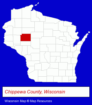
The Wisconsin counties map at upper right shows Chippewa County, highlighted in red. Use the menu below to display interactive maps of Chippewa Falls, either in a frame on this page or in full-screen mode.
Use the menu below to display categorized Chippewa Falls directories.
| Chippewa Falls Products and Services Directory | ||
|---|---|---|
| Auto Body Shops | Auto Service | Clinics |
| Metals | Physicians | Restaurants |
| RV and Camper Dealers | ||
Selected Chippewa Falls, Wisconsin Listings
These randomly selected Chippewa Falls listings provide some insight into the city's cultural environment and economic climate.- Beauty Salons
- Barbers
- Manicures & Pedicures
- Tanning Salons
- Industrial Equipment & Supplies Wholesale & Manufacturers
- Machine Shops
- CNC Machining, Turning & Milling Shops
- Tool & Die Makers
- Audio Equipment & Supplies Dealers
- Stereo Equipment Dealers
- Sound Equipment & Systems Sales, Rental & Leasing
- Audiovisual Equipment Service & Repair
- Child Care Services
- Private Schools
- Music Instruction
- Building Contractors
- Home Builders & Developers
- Insurance
- Signs Wholesale & Manufacturers
- Truck Striping & Lettering
- Public Golf Courses
- Insurance
- Real Estate Agencies & Brokerage
- Real Estate Agents
- Real Estate Appraisers
- Escrow Services
- Home Improvement & Maintenance
- Building & Home Construction
- Special Trades Contractors
- Painting Contractors
- Paint Stores
- Clinics
- Hospitals
- Medical Diagnostic Clinics
- Alternative Medicine
- Family & General Practice Physicians & Surgeons
- General Practice
- Nurse Practitioners
- Printing Services
- Computer & Equipment Dealers
- Computers & Equipment Repair & Maintenance
- Computer Printers
- Auto Auctions
Nearby Wisconsin Cities and Towns *
- Baldwin (1) - Baldwin, Wisconsin information and maps.
- Eau Claire (27) - Eau Claire, Wisconsin solutions directory and maps.
- Holmen (1) - Holmen, Wisconsin information and maps.
- Menomonie (6) - Menomonie, Wisconsin demographics and maps.
- Rice Lake (1) - Rice Lake, Wisconsin information and maps.
* Parenthesized numbers indicate economic activity levels.
Copyright © 2011-2026 RegionalDirectory.us. All rights reserved.