Manitowoc, Wisconsin Map and Directory
Regional Directory > States Menu > Wisconsin
 According to the United States Census Bureau, Manitowoc is a City that is located in Manitowoc County, Wisconsin at 44.09 degrees North and 87.66 degrees West.
The city's time zone is America/Chicago, and the city's primary telephone area code is 920.
The land area of Manitowoc is about 17.72 square miles, whereas the water area of the city is about 0.36 square miles.
Manitowoc County's land area is about 589 square miles, so the city occupies about 3.0 percent of the county's total land area.
According to the United States Census Bureau, Manitowoc is a City that is located in Manitowoc County, Wisconsin at 44.09 degrees North and 87.66 degrees West.
The city's time zone is America/Chicago, and the city's primary telephone area code is 920.
The land area of Manitowoc is about 17.72 square miles, whereas the water area of the city is about 0.36 square miles.
Manitowoc County's land area is about 589 square miles, so the city occupies about 3.0 percent of the county's total land area.
The Census Bureau estimates that Manitowoc had about 32,579 residents in 2019, which is approximately 1,839 people per square mile of land area.
According to recent American Community Survey data, the median household income in Manitowoc was about $47,861 per year.
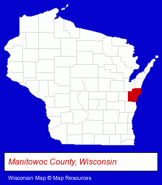
The Wisconsin counties map at upper right shows Manitowoc County, highlighted in red. Use the menu below to display interactive maps of Manitowoc, either in a frame on this page or in full-screen mode.
Use the menu below to display categorized Manitowoc directories.
| Manitowoc Products and Services Directory | ||
|---|---|---|
| Accountants | Attorneys | Auto Engine Services |
| Auto Service | Dentists | Financial Services |
| Landscape Contractors | Metals | Restaurants |
Selected Manitowoc, Wisconsin Listings
These randomly selected Manitowoc listings provide some insight into the city's cultural environment and economic climate.- Financing
- Clinics & Medical Centers
- Clinics
- Charitable & Nonprofit Organizations
- Social & Human Services Organizations
- Builders & Contractors
- Building Contractors
- Home Builders & Developers
- Siding Contractors
- Take Out
- Periodontics Dentists
- Orthodontics Dentists
- Churches
- Schools
- Preschools & Kindergartens
- Lutheran Churches
- Agricultural Equipment & Supplies Retail
- Farm Equipment & Supplies Dealers
- Saddles & Harnesses
- Major Appliance Service & Repair
- Chambers of Commerce
- Physicians & Surgeons
- General Practice
- Embroidery Service
- Engineers
- Engineering Services
- Engineering Equipment & Supplies
- Hearing Aids & Assistive Devices Retail
- Hearing Aid & Assistive Device Service & Repair
- Audiologists
- Churches
- Schools
- Preschools & Kindergartens
- Lutheran Churches
- Heating Contractors
- Heating & Ventilating Contractors
- Auto Body Repair & Painting
Nearby Wisconsin Cities and Towns *
- De Pere (6) - De Pere, Wisconsin demographics and maps.
- Kaukauna (6) - Kaukauna, Wisconsin demographics and maps.
- Oostburg (1) - Oostburg, Wisconsin information and maps.
- Sheboygan (17) - Sheboygan, Wisconsin solutions directory and maps.
- Sheboygan Falls (1) - Sheboygan Falls, Wisconsin information and maps.
- Two Rivers (2) - Two Rivers, Wisconsin information and maps.
* Parenthesized numbers indicate economic activity levels.
Copyright © 2011-2026 RegionalDirectory.us. All rights reserved.