Mount Horeb, Wisconsin Map and Directory
Regional Directory > States Menu > Wisconsin
 According to the United States Census Bureau, Mount Horeb is a Village that is located in Dane County, Wisconsin at 43.01 degrees North and 89.74 degrees West.
The village's time zone is America/Chicago, and the village's primary telephone area code is 608.
The land area of Mount Horeb is about 3.22 square miles, whereas the water area of the village is about 0.00 square miles.
Dane County's land area is about 1,197 square miles, so the village occupies about 0.3 percent of the county's total land area.
According to the United States Census Bureau, Mount Horeb is a Village that is located in Dane County, Wisconsin at 43.01 degrees North and 89.74 degrees West.
The village's time zone is America/Chicago, and the village's primary telephone area code is 608.
The land area of Mount Horeb is about 3.22 square miles, whereas the water area of the village is about 0.00 square miles.
Dane County's land area is about 1,197 square miles, so the village occupies about 0.3 percent of the county's total land area.
The Census Bureau estimates that Mount Horeb had about 7,534 residents in 2019, which is approximately 2,340 people per square mile of land area.
According to recent American Community Survey data, the median household income in Mount Horeb was about $79,900 per year.
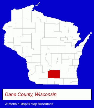
The Wisconsin counties map at upper right shows Dane County, highlighted in red. Use the menu below to display interactive maps of Mount Horeb, either in a frame on this page or in full-screen mode.
Use the menu below to display categorized Mount Horeb directories.
| Mount Horeb Products and Services Directory | |
|---|---|
| Building Contractors | Restaurants |
Selected Mount Horeb, Wisconsin Listings
These representative Mount Horeb listings provide some insight into the village's cultural environment and economic climate.- Accountants
- Heating Contractors
- Heating & Ventilating Contractors
- Building Remodeling & Repair Contractors
- Electric Companies
- Electric Wire & Cable
- Remodeling & Repair Contractors Commercial
- Dentists
- Cosmetic Dentists
- Builders & Contractors
- Building Contractors
- Boarding Stables
- Hotels
- Hotel & Motel Reservations
- Attorneys
- Personal Injury Attorneys
- Criminal Law Attorneys
- Family Law Attorneys
- Real Estate Attorneys
- Lawn & Garden Equipment & Supplies Retail
- Libraries
- Gift Shops
- Builders & Contractors
- Building Contractors
- Electric Contractors
- Environmental Engineers
- Visual Arts
- Art Galleries & Dealers
Nearby Wisconsin Cities and Towns *
- Lodi (1) - Lodi, Wisconsin information and maps.
- Madison (105) - Madison, Wisconsin products & services directory.
- Middleton (11) - Middleton, Wisconsin demographics and directory.
- New Glarus (1) - New Glarus, Wisconsin information and maps.
- Oregon (2) - Oregon, Wisconsin information and maps.
- Verona (5) - Verona, Wisconsin demographics and maps.
- Waunakee (1) - Waunakee, Wisconsin information and maps.
* Parenthesized numbers indicate economic activity levels.
Copyright © 2011-2026 RegionalDirectory.us. All rights reserved.