West Allis, Wisconsin Map and Directory
Regional Directory > States Menu > Wisconsin
 According to the United States Census Bureau, West Allis is a City that is located in Milwaukee County, Wisconsin at 43.02 degrees North and 88.01 degrees West.
The city's time zone is America/Chicago, and the city's primary telephone area code is 414.
The land area of West Allis is about 11.39 square miles, whereas the water area of the city is about 0.02 square miles.
Milwaukee County's land area is about 241 square miles, so the city occupies about 4.7 percent of the county's total land area.
According to the United States Census Bureau, West Allis is a City that is located in Milwaukee County, Wisconsin at 43.02 degrees North and 88.01 degrees West.
The city's time zone is America/Chicago, and the city's primary telephone area code is 414.
The land area of West Allis is about 11.39 square miles, whereas the water area of the city is about 0.02 square miles.
Milwaukee County's land area is about 241 square miles, so the city occupies about 4.7 percent of the county's total land area.
The Census Bureau estimates that West Allis had about 59,890 residents in 2019, which is approximately 5,258 people per square mile of land area.
According to recent American Community Survey data, the median household income in West Allis was about $52,325 per year.
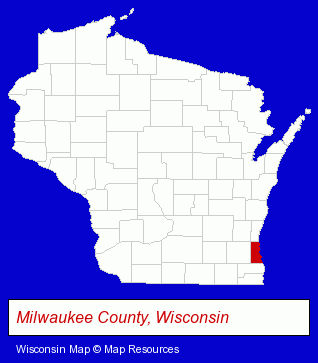
The Wisconsin counties map at upper right shows Milwaukee County, highlighted in red. Use the menu below to display interactive maps of West Allis, either in a frame on this page or in full-screen mode.
Use the menu below to display categorized West Allis directories.
| West Allis Products and Services Directory | |
|---|---|
| Insurance | Roofing Contractors |
Selected West Allis, Wisconsin Listings
These representative West Allis listings provide some insight into the city's cultural environment and economic climate.- Air Conditioning Contractors
- Building Contractors
- Roofing Contractors
- Government Contractors
- Chambers of Commerce
- Chemicals - Manufacturers
- Mortgages
- Credit Unions
- Mortgage & Loan Banks
- Escrow Services
- Accountants
- Tax Return Preparation
- Insurance Agents & Brokers
- Insurance Claims & Services
- Painting Contractors
- Painting Contractors
- Painting Contractors Commercial & Industrial
- Dentists
- Prosthodontics Dentists
- Auto Service & Repair
- Attorneys
- Churches
- Libraries
- Lutheran Churches
- Public Libraries
- Special Interest Libraries
- Jewelers
- Jewelry Repair
- Watch Service & Repair
- Jewelry Brokers & Buyers
- Antiques
- Antique Dealers
- Collectibles Dealers
- Restaurants
- Physicians & Surgeons
- Family & General Practice Physicians & Surgeons
- General Practice
- Restaurants
- Coffee & Tea Shops
- Take Out
- Government Contractors
- Painting Contractors
- Carpet, Rug & Upholstery Cleaning
- Janitorial Services
- Housecleaning
- Carpet, Rug & Upholstery Cleaning Commercial & Industrial
- Window Cleaning
- Movers
- Piano & Organ Movers
- Moving Equipment & Supplies Rental
- Packaging & Shipping Services
- Freight Forwarding
- Package Shipping Agents
- Marine Cargo & Freight
- Rubber, Metal & Plastic Stamps
Nearby Wisconsin Cities and Towns *
- Brookfield (25) - Brookfield, Wisconsin solutions directory and maps.
- Cudahy (3) - Cudahy, Wisconsin information and maps.
- Milwaukee (136) - Milwaukee, Wisconsin products & services directory.
- New Berlin (11) - New Berlin, Wisconsin demographics and directory.
- Oak Creek (3) - Oak Creek, Wisconsin information and maps.
- Waukesha (33) - Waukesha, Wisconsin products & services directory.
* Parenthesized numbers indicate economic activity levels.
Copyright © 2011-2026 RegionalDirectory.us. All rights reserved.