West Bend, Wisconsin Map and Directory
Regional Directory > States Menu > Wisconsin
 According to the United States Census Bureau, West Bend is a City that is located in Washington County, Wisconsin at 43.43 degrees North and 88.18 degrees West.
The city's time zone is America/Chicago, and the city's primary telephone area code is 262.
The land area of West Bend is about 15.07 square miles, whereas the water area of the city is about 0.16 square miles.
Washington County's land area is about 431 square miles, so the city occupies about 3.5 percent of the county's total land area.
According to the United States Census Bureau, West Bend is a City that is located in Washington County, Wisconsin at 43.43 degrees North and 88.18 degrees West.
The city's time zone is America/Chicago, and the city's primary telephone area code is 262.
The land area of West Bend is about 15.07 square miles, whereas the water area of the city is about 0.16 square miles.
Washington County's land area is about 431 square miles, so the city occupies about 3.5 percent of the county's total land area.
The Census Bureau estimates that West Bend had about 31,563 residents in 2019, which is approximately 2,094 people per square mile of land area.
According to recent American Community Survey data, the median household income in West Bend was about $60,910 per year.
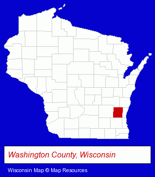
The Wisconsin counties map at upper right shows Washington County, highlighted in red. Use the menu below to display interactive maps of West Bend, either in a frame on this page or in full-screen mode.
Use the menu below to display categorized West Bend directories.
| West Bend Products and Services Directory | ||
|---|---|---|
| Animal Hospitals | Attorneys | Auto Service |
| Building Contractors | Building Materials | Chiropractors |
| Concrete Contractors | Dentists | Home Furnishings |
| Home Improvement | Insurance | Physicians |
| Printing and Publishing | Veterinarians | |
Selected West Bend, Wisconsin Listings
These randomly selected West Bend listings provide some insight into the city's cultural environment and economic climate.- Driver Training
- Defensive Driving Instruction
- Housewares Stores
- Vacuum Cleaner Dealers
- Small Appliance Service & Repair
- Vacuum Cleaning Systems
- Carpet Cleaning Products Wholesale & Manufacturers
- Masonry Contractors
- Alternative Medicine
- Chiropractors
- Alternative Medicine Practitioners
- Certified & Registered Massage Therapists
- Importers
- Agricultural Equipment & Supplies Retail
- Farm Equipment & Supplies Dealers
- Exporters
- Construction Machinery & Equipment Wholesale & Manufacturers
- Industrial Equipment & Supplies Dealers
- Industrial Equipment & Supplies Wholesale & Manufacturers
- Tool & Die Makers
- Tool & Die Maker Equipment & Supplies
- Jewelers
- Jewelry Repair
- Diamonds Retail
- Hearing Aids & Assistive Devices Retail
- Hearing Aid & Assistive Device Service & Repair
- Audiologists
- Physical Therapy Equipment Wholesale & Manufacturers
- Embroidery & Needlework Supplies Retail
- Sewing Machine Dealers
- Sewing Machine Service & Repair
- Carpenters
Nearby Wisconsin Cities and Towns *
- Cedarburg (5) - Cedarburg, Wisconsin demographics and maps.
- Grafton (3) - Grafton, Wisconsin information and maps.
- Hartford (4) - Hartford, Wisconsin information and maps.
- Menomonee Falls (12) - Menomonee Falls, Wisconsin demographics and directory.
- Mequon (3) - Mequon, Wisconsin information and maps.
- Thiensville (4) - Thiensville, Wisconsin information and maps.
* Parenthesized numbers indicate economic activity levels.
Copyright © 2011-2026 RegionalDirectory.us. All rights reserved.