Wisconsin Rapids, Wisconsin Map and Directory
Regional Directory > States Menu > Wisconsin
 According to the United States Census Bureau, Wisconsin Rapids is a City that is located in Wood County, Wisconsin at 44.38 degrees North and 89.82 degrees West.
The city's time zone is America/Chicago, and the city's primary telephone area code is 715.
The land area of Wisconsin Rapids is about 13.89 square miles, whereas the water area of the city is about 0.85 square miles.
Wood County's land area is about 793 square miles, so the city occupies about 1.8 percent of the county's total land area.
According to the United States Census Bureau, Wisconsin Rapids is a City that is located in Wood County, Wisconsin at 44.38 degrees North and 89.82 degrees West.
The city's time zone is America/Chicago, and the city's primary telephone area code is 715.
The land area of Wisconsin Rapids is about 13.89 square miles, whereas the water area of the city is about 0.85 square miles.
Wood County's land area is about 793 square miles, so the city occupies about 1.8 percent of the county's total land area.
The Census Bureau estimates that Wisconsin Rapids had about 17,610 residents in 2019, which is approximately 1,268 people per square mile of land area.
According to recent American Community Survey data, the median household income in Wisconsin Rapids was about $42,531 per year.
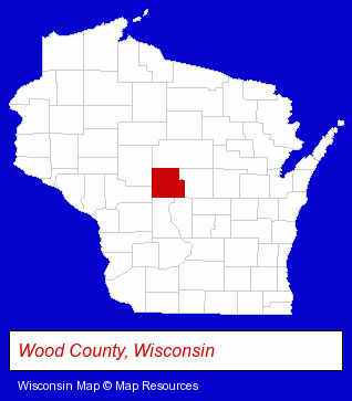
The Wisconsin counties map at upper right shows Wood County, highlighted in red. Use the menu below to display interactive maps of Wisconsin Rapids, either in a frame on this page or in full-screen mode.
Use the menu below to display categorized Wisconsin Rapids directories.
| Wisconsin Rapids Products and Services Directory | ||
|---|---|---|
| Auto Service | Building Materials | Home Improvement |
| Physicians | Restaurants | Schools |
| Sporting Goods Dealers | ||
Selected Wisconsin Rapids, Wisconsin Listings
These randomly selected Wisconsin Rapids listings provide some insight into the city's cultural environment and economic climate.- Public Golf Courses
- Private Golf Courses
- Private Golf Clubs
- Dentists
- Camps
- Truck Parts & Equipment Wholesale & Manufacturers
- RV Parts & Equipment Wholesale & Manufacturers
- Snowmobiles Repair & Maintenance
- Rubber, Metal & Plastic Stamps
- Insulation Contractors
- Coffee & Tea Shops
- Lubricating Oils Retail
- Banquet Facilities
- Hotels
- Metals
- Sheet Metal Contractors
- Mechanical Contractors
- Vocational Education
- Air Transportation
- Aircraft Charter, Rental & Leasing
- Aviation Schools
Nearby Wisconsin Cities and Towns *
- Mosinee (2) - Mosinee, Wisconsin information and maps.
- Schofield (3) - Schofield, Wisconsin information and maps.
- Stevens Point (9) - Stevens Point, Wisconsin demographics and directory.
- Wausau (20) - Wausau, Wisconsin solutions directory and maps.
- Wisconsin Dells (5) - Wisconsin Dells, Wisconsin demographics and maps.
* Parenthesized numbers indicate economic activity levels.
Copyright © 2011-2026 RegionalDirectory.us. All rights reserved.