Foley, Alabama Map and Directory
Regional Directory > States Menu > Alabama
 According to the United States Census Bureau, Foley is a City that is located in Baldwin County, Alabama at 30.41 degrees North and 87.68 degrees West.
The city's time zone is America/Chicago, and the city's primary telephone area code is 251.
The land area of Foley is about 31.20 square miles, whereas the water area of the city is about 0.13 square miles.
Baldwin County's land area is about 1,590 square miles, so the city occupies about 2.0 percent of the county's total land area.
According to the United States Census Bureau, Foley is a City that is located in Baldwin County, Alabama at 30.41 degrees North and 87.68 degrees West.
The city's time zone is America/Chicago, and the city's primary telephone area code is 251.
The land area of Foley is about 31.20 square miles, whereas the water area of the city is about 0.13 square miles.
Baldwin County's land area is about 1,590 square miles, so the city occupies about 2.0 percent of the county's total land area.
The Census Bureau estimates that Foley had about 20,391 residents in 2019, which is approximately 654 people per square mile of land area.
According to recent American Community Survey data, the median household income in Foley was about $43,614 per year.
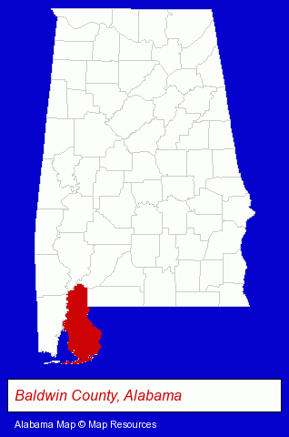
The Alabama counties map at upper right shows Baldwin County, highlighted in red. Use the menu below to display interactive maps of Foley, either in a frame on this page or in full-screen mode.
Use the menu below to display categorized Foley directories.
| Foley Directory Page: | Home Improvement |
|---|
Nearby Alabama Cities and Towns *
- Daphne (2) - Daphne, Alabama information and maps.
- Fairhope (3) - Fairhope, Alabama information and maps.
- Gulf Shores (3) - Gulf Shores, Alabama information and maps.
- Mobile (28) - Mobile, Alabama solutions directory and maps.
- Montgomery (23) - Montgomery, Alabama solutions directory and maps.
- Orange Beach (4) - Orange Beach, Alabama information and maps.
- Theodore (1) - Theodore, Alabama information and maps.
Large and Mid-size Cities in Nearby States
- Pensacola, Florida (33) - Pensacola, FL solutions directory and maps.
* Parenthesized numbers indicate economic activity levels.
Copyright © 2011-2024 RegionalDirectory.us. All rights reserved.