Pell City, Alabama Map and Directory
Regional Directory > States Menu > Alabama
 According to the United States Census Bureau, Pell City is a City that is located in St. Clair County, Alabama at 33.59 degrees North and 86.29 degrees West.
The city's time zone is America/Chicago, and the city's primary telephone area code is 205.
The land area of Pell City is about 24.88 square miles, whereas the water area of the city is about 2.76 square miles.
According to the United States Census Bureau, Pell City is a City that is located in St. Clair County, Alabama at 33.59 degrees North and 86.29 degrees West.
The city's time zone is America/Chicago, and the city's primary telephone area code is 205.
The land area of Pell City is about 24.88 square miles, whereas the water area of the city is about 2.76 square miles.
The Census Bureau estimates that Pell City had about 14,045 residents in 2019, which is approximately 565 people per square mile of land area.
According to recent American Community Survey data, the median household income in Pell City was about $54,674 per year.
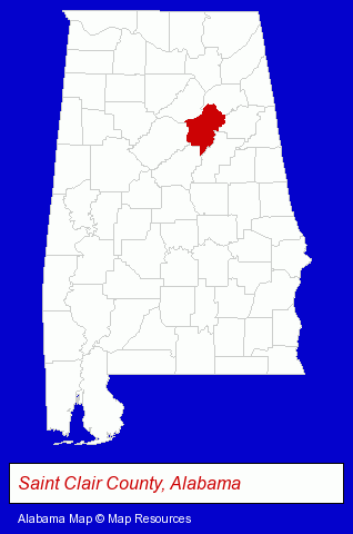
The Alabama counties map at upper right shows St. Clair County, highlighted in red. Use the menu below to display interactive maps of Pell City, either in a frame on this page or in full-screen mode.
Use the menu below to display categorized Pell City directories.
| Pell City Directory Page: | Schools |
|---|
Selected Pell City, Alabama Listings
These Pell City listings provide some insight into the city's cultural environment and economic climate. Bower Inc- Medical Equipment & Supplies Retail
- Churches
- Schools
- Church & Religious Associations & Organizations
- Baptist Churches
- Private Schools
- Elementary & Secondary Education
- Elementary Schools
- Public Schools
- Public Schools
- Educational Services
- County Government
Nearby Alabama Cities and Towns *
- Anniston (5) - Anniston, Alabama demographics and maps.
- Bessemer (3) - Bessemer, Alabama information and maps.
- Birmingham (58) - Birmingham, Alabama products & services directory.
- Gadsden (4) - Gadsden, Alabama information and maps.
- Huntsville (28) - Huntsville, Alabama solutions directory and maps.
- Pelham (2) - Pelham, Alabama information and maps.
- Trussville (3) - Trussville, Alabama information and maps.
* Parenthesized numbers indicate economic activity levels.
Copyright © 2011-2024 RegionalDirectory.us. All rights reserved.