Ladera Ranch, California Map and Directory
Regional Directory > States Menu > California
 According to the United States Census Bureau, Ladera Ranch is a Census-designated Place that is located in Orange County, California at 33.57 degrees North and 117.64 degrees West.
The place's time zone is America/Los Angeles, and the place's primary telephone area code is 949.
The land area of Ladera Ranch is about 4.84 square miles, whereas the water area of the place is about 0.00 square miles.
Orange County's land area is about 791 square miles, so the place occupies about 0.6 percent of the county's total land area.
According to the United States Census Bureau, Ladera Ranch is a Census-designated Place that is located in Orange County, California at 33.57 degrees North and 117.64 degrees West.
The place's time zone is America/Los Angeles, and the place's primary telephone area code is 949.
The land area of Ladera Ranch is about 4.84 square miles, whereas the water area of the place is about 0.00 square miles.
Orange County's land area is about 791 square miles, so the place occupies about 0.6 percent of the county's total land area.
The Census Bureau estimates that Ladera Ranch had about 27,277 residents in 2019, which is approximately 5,636 people per square mile of land area.
According to recent American Community Survey data, the median household income in Ladera Ranch was about $161,348 per year.
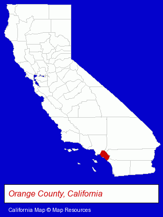
The California counties map at upper right shows Orange County, highlighted in red. Use the menu below to display interactive maps of Ladera Ranch, either in a frame on this page or in full-screen mode.
Use the menu below to display categorized Ladera Ranch directories.
| Ladera Ranch Directory Page: | Physicians |
|---|
Nearby California Cities and Towns *
- Aliso Viejo (5) - Aliso Viejo, California demographics and maps.
- Laguna Hills (15) - Laguna Hills, California demographics and directory.
- Laguna Niguel (5) - Laguna Niguel, California demographics and maps.
- Lake Forest (12) - Lake Forest, California demographics and directory.
- Mission Viejo (20) - Mission Viejo, California solutions directory and maps.
- Rancho Santa Margarita (2) - Rancho Santa Margarita, California information and maps.
- San Juan Capistrano (6) - San Juan Capistrano, California demographics and maps.
* Parenthesized numbers indicate economic activity levels.
Copyright © 2011-2024 RegionalDirectory.us. All rights reserved.