Manitou Springs, Colorado Map and Directory
Regional Directory > States Menu > Colorado
 According to the United States Census Bureau, Manitou Springs is a City that is located in El Paso County, Colorado at 38.86 degrees North and 104.92 degrees West.
The city's time zone is America/Denver, and the city's primary telephone area code is 719.
The land area of Manitou Springs is about 3.16 square miles, whereas the water area of the city is about 0.00 square miles.
El Paso County's land area is about 2,127 square miles, so the city occupies about 0.1 percent of the county's total land area.
According to the United States Census Bureau, Manitou Springs is a City that is located in El Paso County, Colorado at 38.86 degrees North and 104.92 degrees West.
The city's time zone is America/Denver, and the city's primary telephone area code is 719.
The land area of Manitou Springs is about 3.16 square miles, whereas the water area of the city is about 0.00 square miles.
El Paso County's land area is about 2,127 square miles, so the city occupies about 0.1 percent of the county's total land area.
The Census Bureau estimates that Manitou Springs had about 5,390 residents in 2019, which is approximately 1,706 people per square mile of land area.
According to recent American Community Survey data, the median household income in Manitou Springs was about $62,270 per year.
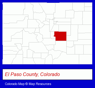
The Colorado counties map at upper right shows El Paso County, highlighted in red. Use the menu below to display interactive maps of Manitou Springs, either in a frame on this page or in full-screen mode.
Use the menu below to display categorized Manitou Springs directories.
| Manitou Springs Products and Services Directory | |
|---|---|
| Hotels | Restaurants |
Selected Manitou Springs, Colorado Listings
These representative Manitou Springs listings in 80829 provide a window into the city's cultural environment and economic climate. Loop- Mexican Restaurants
- Visual Arts
- Art Galleries & Dealers
- Lodging
- Hotels
- Motels
- Hotel & Motel Reservations
- Business Services
Nearby Colorado Cities and Towns *
- Canon City (2) - Canon City, Colorado information and maps.
- Castle Rock (8) - Castle Rock, Colorado demographics and maps.
- Centennial (1) - Centennial, Colorado information and maps.
- Colorado Springs (62) - Colorado Springs, Colorado products & services directory.
- Littleton (30) - Littleton, Colorado solutions directory and maps.
- Parker (5) - Parker, Colorado demographics and maps.
- Pueblo (9) - Pueblo, Colorado demographics and directory.
* Parenthesized numbers indicate economic activity levels.
Copyright © 2011-2024 RegionalDirectory.us. All rights reserved.