New Albany, Indiana Map and Directory
Regional Directory > States Menu > Indiana
 According to the United States Census Bureau, New Albany is a City that is located in Floyd County, Indiana at 38.29 degrees North and 85.82 degrees West.
The city's time zone is America/Kentucky/Louisville, and the city's primary telephone area code is 812.
The land area of New Albany is about 14.94 square miles, whereas the water area of the city is about 0.17 square miles.
Floyd County's land area is about 148 square miles, so the city occupies about 10.1 percent of the county's total land area.
According to the United States Census Bureau, New Albany is a City that is located in Floyd County, Indiana at 38.29 degrees North and 85.82 degrees West.
The city's time zone is America/Kentucky/Louisville, and the city's primary telephone area code is 812.
The land area of New Albany is about 14.94 square miles, whereas the water area of the city is about 0.17 square miles.
Floyd County's land area is about 148 square miles, so the city occupies about 10.1 percent of the county's total land area.
The Census Bureau estimates that New Albany had about 36,843 residents in 2019, which is approximately 2,466 people per square mile of land area.
According to recent American Community Survey data, the median household income in New Albany was about $48,734 per year.
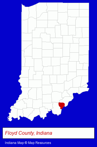
The Indiana counties map at upper right shows Floyd County, highlighted in red. Use the menu below to display interactive maps of New Albany, either in a frame on this page or in full-screen mode.
Use the menu below to display categorized New Albany directories.
| New Albany Products and Services Directory | ||
|---|---|---|
| Auto Engine Services | Auto Service | Building Materials |
| Chiropractors | Home Improvement | Physicians |
| Schools | ||
Selected New Albany, Indiana Listings
These randomly selected New Albany listings provide some insight into the city's cultural environment and economic climate.- Rehabilitation Services
- Osteopathic Physicians & Surgeons
- Sports Medicine Physicians & Surgeons
- Weddings
- Florists
- Wedding Services
- Maxillofacial Physicians & Surgeons
- Oral Surgeons
- Oral & Maxillofacial Pathology & Surgery Dentists
- Printing & Publishing
- Printing Services
- Commercial Printing
- Office Supplies Retail
- Business Forms & Systems
- Building Materials & Supplies Wholesale & Manufacturers
- Pediatrics Physicians & Surgeons
- Nurses
- Nurse Practitioners
- Gynecology & Obstetrics Physicians & Surgeons
- Attorneys
Nearby Indiana Cities and Towns *
- Bedford (3) - Bedford, Indiana information and maps.
- Bloomington (17) - Bloomington, Indiana solutions directory and maps.
- Columbus (12) - Columbus, Indiana demographics and directory.
- Greenwood (6) - Greenwood, Indiana demographics and maps.
- Indianapolis (110) - Indianapolis, Indiana products & services directory.
- Jeffersonville (3) - Jeffersonville, Indiana information and maps.
Large and Mid-size Cities in Nearby States
- Louisville, Kentucky (92) - Louisville, KY products & services directory.
* Parenthesized numbers indicate economic activity levels.
Copyright © 2011-2024 RegionalDirectory.us. All rights reserved.