Capitol Heights, Maryland Map and Directory
Regional Directory > States Menu > Maryland
 According to the United States Census Bureau, Capitol Heights is a Town that is located in Prince George's County, Maryland at 38.89 degrees North and 76.92 degrees West.
The town's time zone is America/New York, and the town's primary telephone area code is 301.
The land area of Capitol Heights is about 0.80 square miles, whereas the water area of the town is about 0.00 square miles.
According to the United States Census Bureau, Capitol Heights is a Town that is located in Prince George's County, Maryland at 38.89 degrees North and 76.92 degrees West.
The town's time zone is America/New York, and the town's primary telephone area code is 301.
The land area of Capitol Heights is about 0.80 square miles, whereas the water area of the town is about 0.00 square miles.
The Census Bureau estimates that Capitol Heights had about 4,546 residents in 2014, which is approximately 5,683 people per square mile of land area.
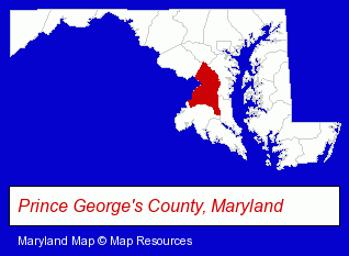
The Maryland counties map at upper right shows Prince George's County, highlighted in red. Use the menu below to display interactive maps of Capitol Heights, either in a frame on this page or in full-screen mode.
Use the menu below to display categorized Capitol Heights directories.
| Capitol Heights Directory Page: | Home Improvement |
|---|
Nearby Maryland Cities and Towns *
- Beltsville (4) - Beltsville, Maryland information and maps.
- Bowie (2) - Bowie, Maryland information and maps.
- Chevy Chase (4) - Chevy Chase, Maryland information and maps.
- Greenbelt (2) - Greenbelt, Maryland information and maps.
- Hyattsville (5) - Hyattsville, Maryland demographics and maps.
- Silver Spring (14) - Silver Spring, Maryland demographics and directory.
- Upper Marlboro (3) - Upper Marlboro, Maryland information and maps.
Large and Mid-size Cities in Nearby States
- Alexandria, Virginia (33) - Alexandria, VA solutions directory and maps.
- Arlington, Virginia (16) - Arlington, VA demographics and directory.
* Parenthesized numbers indicate economic activity levels.
Copyright © 2011-2024 RegionalDirectory.us. All rights reserved.