Manzanita, Oregon Map and Directory
Regional Directory > States Menu > Oregon
 According to the United States Census Bureau, Manzanita is a City that is located in Tillamook County, Oregon at 45.72 degrees North and 123.94 degrees West.
The city's time zone is America/Los Angeles, and the city's primary telephone area code is 503.
The land area of Manzanita is about 0.82 square miles, whereas the water area of the city is about 0.00 square miles.
Tillamook County's land area is about 1,103 square miles, so the city occupies about 0.1 percent of the county's total land area.
According to the United States Census Bureau, Manzanita is a City that is located in Tillamook County, Oregon at 45.72 degrees North and 123.94 degrees West.
The city's time zone is America/Los Angeles, and the city's primary telephone area code is 503.
The land area of Manzanita is about 0.82 square miles, whereas the water area of the city is about 0.00 square miles.
Tillamook County's land area is about 1,103 square miles, so the city occupies about 0.1 percent of the county's total land area.
The Census Bureau estimates that Manzanita had about 613 residents in 2014, which is approximately 748 people per square mile of land area.
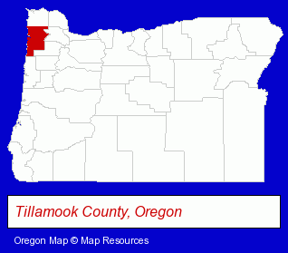
The Oregon counties map at upper right shows Tillamook County, highlighted in red. Use the menu below to display interactive maps of Manzanita, either in a frame on this page or in full-screen mode.
Use the menu below to display categorized Manzanita directories.
| Manzanita Products and Services Directory | |
|---|---|
| Hotels | Vacation Home Rental |
Selected Manzanita, Oregon Listings
These representative Manzanita listings provide some insight into the city's cultural environment and economic climate. Inn at Manzanita- Lodging
- Hotels
- Motels
- Restaurants
- Mexican Restaurants
- General Real Estate
- Real Estate Rental & Leasing
- Property Management
- Real Estate Commercial & Industrial
- Vacation Home Rental
- Lodging
- Hotels
- Motels
Nearby Oregon Cities and Towns *
- Astoria (6) - Astoria, Oregon demographics and maps.
- Cannon Beach (3) - Cannon Beach, Oregon information and maps.
- Forest Grove (3) - Forest Grove, Oregon information and maps.
- Hillsboro (20) - Hillsboro, Oregon solutions directory and maps.
- McMinnville (5) - McMinnville, Oregon demographics and maps.
- Rockaway Beach (1) - Rockaway Beach, Oregon information and maps.
- Seaside (2) - Seaside, Oregon information and maps.
* Parenthesized numbers indicate economic activity levels.
Copyright © 2011-2024 RegionalDirectory.us. All rights reserved.