Eureka Springs, Arkansas Map and Directory
Regional Directory > States Menu > Arkansas
 According to the United States Census Bureau, Eureka Springs is a City that is located in Carroll County, Arkansas at 36.40 degrees North and 93.74 degrees West.
The city's time zone is America/Chicago, and the city's primary telephone area code is 501.
The land area of Eureka Springs is about 6.77 square miles, whereas the water area of the city is about 0.14 square miles.
Carroll County's land area is about 630 square miles, so the city occupies about 1.1 percent of the county's total land area.
According to the United States Census Bureau, Eureka Springs is a City that is located in Carroll County, Arkansas at 36.40 degrees North and 93.74 degrees West.
The city's time zone is America/Chicago, and the city's primary telephone area code is 501.
The land area of Eureka Springs is about 6.77 square miles, whereas the water area of the city is about 0.14 square miles.
Carroll County's land area is about 630 square miles, so the city occupies about 1.1 percent of the county's total land area.
The Census Bureau estimates that Eureka Springs had about 2,086 residents in 2014, which is approximately 308 people per square mile of land area.
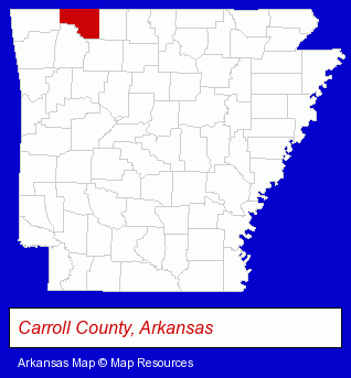
The Arkansas counties map at upper right shows Carroll County, highlighted in red. Use the menu below to display interactive maps of Eureka Springs, either in a frame on this page or in full-screen mode.
Use the menu below to display categorized Eureka Springs directories.
| Eureka Springs Products and Services Directory | ||
|---|---|---|
| Hotels | Restaurants | Steak Restaurants |
| Vacation Home Rental | Visual Arts | |
Selected Eureka Springs, Arkansas Listings
These randomly selected Eureka Springs listings provide some insight into the city's cultural environment and economic climate.- Weddings
- Wedding Chapels
- Vacation Home Rental
- Cabin, Cottage & Chalet Rental
- Hunting
- Fishing Guides & Charters
- Hunting Guides
- Art Galleries & Dealers
- Italian Restaurants
- Florists
- Gift Shops
- Gift Baskets & Packs Retail
- General Merchandise Wholesale
- Gifts Wholesale & Manufacturers
- Lodging
- Bed & Breakfasts
- Vacation Home Rental
- Cabin, Cottage & Chalet Rental
- Resorts & Vacation Cottages
- Vacation Home Rental
- Cabin, Cottage & Chalet Rental
- Resorts Reservations
Nearby Arkansas Cities and Towns *
- Fayetteville (14) - Fayetteville, Arkansas demographics and directory.
- Fort Smith (11) - Fort Smith, Arkansas demographics and directory.
- Harrison (2) - Harrison, Arkansas information and maps.
- Mountain Home (6) - Mountain Home, Arkansas demographics and maps.
- Rogers (8) - Rogers, Arkansas demographics and maps.
- Springdale (5) - Springdale, Arkansas demographics and maps.
* Parenthesized numbers indicate economic activity levels.
Copyright © 2011-2026 RegionalDirectory.us. All rights reserved.