Rogers, Arkansas Map and Directory
Regional Directory > States Menu > Arkansas
 According to the United States Census Bureau, Rogers is a City that is located in Benton County, Arkansas at 36.33 degrees North and 94.12 degrees West.
The city's time zone is America/Chicago, and the city's primary telephone area code is 501.
The land area of Rogers is about 37.92 square miles, whereas the water area of the city is about 0.18 square miles.
Benton County's land area is about 847 square miles, so the city occupies about 4.5 percent of the county's total land area.
According to the United States Census Bureau, Rogers is a City that is located in Benton County, Arkansas at 36.33 degrees North and 94.12 degrees West.
The city's time zone is America/Chicago, and the city's primary telephone area code is 501.
The land area of Rogers is about 37.92 square miles, whereas the water area of the city is about 0.18 square miles.
Benton County's land area is about 847 square miles, so the city occupies about 4.5 percent of the county's total land area.
The Census Bureau estimates that Rogers had about 68,669 residents in 2019, which is approximately 1,811 people per square mile of land area.
According to recent American Community Survey data, the median household income in Rogers was about $61,551 per year.
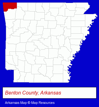
The Arkansas counties map at upper right shows Benton County, highlighted in red. Use the menu below to display interactive maps of Rogers, either in a frame on this page or in full-screen mode.
Use the menu below to display categorized Rogers directories.
| Rogers Products and Services Directory | ||
|---|---|---|
| Attorneys | Auto Service | Clinics |
| Dental Clinics | Dentists | Home Improvement |
| Physicians | Printing and Publishing | |
Selected Rogers, Arkansas Listings
These randomly selected Rogers listings provide some insight into the city's cultural environment and economic climate.- Sporting Goods Dealers
- Housewares Stores
- Housewares Wholesale & Manufacturers
- Kitchenware & Glassware Retail
- Knives & Cutlery Retail
- Food Products Wholesale & Manufacturers
- Plastic & Plastic Products Wholesale & Manufacturers
- Plastic Molders
- Plastic Molds Manufacturers
- Medical Equipment & Supplies Retail
- Gift Shops
- Toy Stores
- Plastic & Plastic Products Wholesale & Manufacturers
- Plastic Molders
- Plastic Molds Manufacturers
- Plastic Foam Products
- Auto Parts Retail
- Industrial Equipment Rebuilding, Service & Repair
- Brake Service & Repair
- Auto Air Conditioning & Heating Service & Repair
- Clinics
- Dental Clinics
- Auto Parts Wholesale & Manufacturers
- Used & Rebuilt Auto Parts Wholesale & Manufacturers
- Industrial Equipment & Supplies Dealers
- Industrial Equipment & Supplies Wholesale & Manufacturers
- Engineers
- Civil Engineers
- Professional Engineers
- Structural Engineers
- Environmental Engineers
- Industrial Equipment & Supplies Wholesale & Manufacturers
- Tool & Die Makers
Nearby Arkansas Cities and Towns *
- Eureka Springs (5) - Eureka Springs, Arkansas demographics and maps.
- Fayetteville (14) - Fayetteville, Arkansas demographics and directory.
- Fort Smith (11) - Fort Smith, Arkansas demographics and directory.
- Harrison (2) - Harrison, Arkansas information and maps.
- Mountain Home (6) - Mountain Home, Arkansas demographics and maps.
- Springdale (5) - Springdale, Arkansas demographics and maps.
* Parenthesized numbers indicate economic activity levels.
Copyright © 2011-2026 RegionalDirectory.us. All rights reserved.