Cottonwood, Arizona Map and Directory
Regional Directory > States Menu > Arizona
 According to the United States Census Bureau, Cottonwood is a City that is located in Yavapai County, Arizona at 34.74 degrees North and 112.01 degrees West.
The city's time zone is America/Phoenix, and the city's primary telephone area code is 928.
The land area of Cottonwood is about 16.59 square miles, whereas the water area of the city is about 0.00 square miles.
Yavapai County's land area is about 8,124 square miles, so the city occupies about 0.2 percent of the county's total land area.
According to the United States Census Bureau, Cottonwood is a City that is located in Yavapai County, Arizona at 34.74 degrees North and 112.01 degrees West.
The city's time zone is America/Phoenix, and the city's primary telephone area code is 928.
The land area of Cottonwood is about 16.59 square miles, whereas the water area of the city is about 0.00 square miles.
Yavapai County's land area is about 8,124 square miles, so the city occupies about 0.2 percent of the county's total land area.
The Census Bureau estimates that Cottonwood had about 12,253 residents in 2019, which is approximately 739 people per square mile of land area.
According to recent American Community Survey data, the median household income in Cottonwood was about $42,500 per year.
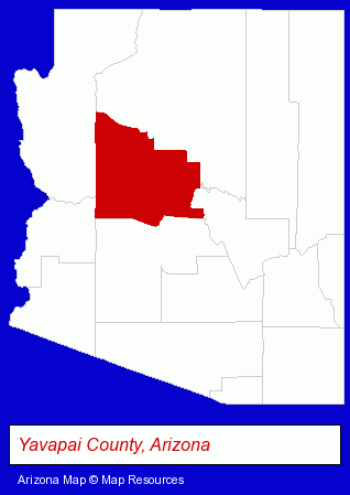
The Arizona counties map at upper right shows Yavapai County, highlighted in red. Use the menu below to display interactive maps of Cottonwood, either in a frame on this page or in full-screen mode.
Use the menu below to display categorized Cottonwood directories.
| Cottonwood Products and Services Directory | ||
|---|---|---|
| Auto Service | Home Improvement | Physicians |
Selected Cottonwood, Arizona Listings
These representative Cottonwood listings provide some insight into the city's cultural environment and economic climate.- Schools
- Elementary & Secondary Education
- Private Schools
- High Schools
- Junior High & Middle Schools
- Banks
- Financial Institutions
- Personal Loans
- Mortgage & Loan Banks
- Elementary & Secondary Education
- Vocational Education
- Junior Colleges & Technical Institutes
- Hobbies
- Hobby & Model Stores
- Lodging
- Hotels
- Motels
- Pediatrics Physicians & Surgeons
- Outdoor Sports & Recreation
- Campgrounds & RV Parks
- Fuels Retail
- Propane & Natural Gas
Nearby Arizona Cities and Towns *
- Flagstaff (14) - Flagstaff, Arizona demographics and directory.
- Glendale (15) - Glendale, Arizona demographics and directory.
- Jerome (1) - Jerome, Arizona information and maps.
- Peoria (8) - Peoria, Arizona demographics and maps.
- Prescott (11) - Prescott, Arizona demographics and directory.
- Prescott Valley (4) - Prescott Valley, Arizona information and maps.
- Sedona (6) - Sedona, Arizona demographics and maps.
* Parenthesized numbers indicate economic activity levels.
Copyright © 2011-2026 RegionalDirectory.us. All rights reserved.