Danville, California Map and Directory
Regional Directory > States Menu > California
 According to the United States Census Bureau, Danville is a Town that is located in Contra Costa County, California at 37.82 degrees North and 122.00 degrees West.
The town's time zone is America/Los Angeles, and the town's primary telephone area code is 925.
The land area of Danville is about 18.08 square miles, whereas the water area of the town is about 0.00 square miles.
Contra Costa County's land area is about 716 square miles, so the town occupies about 2.5 percent of the county's total land area.
According to the United States Census Bureau, Danville is a Town that is located in Contra Costa County, California at 37.82 degrees North and 122.00 degrees West.
The town's time zone is America/Los Angeles, and the town's primary telephone area code is 925.
The land area of Danville is about 18.08 square miles, whereas the water area of the town is about 0.00 square miles.
Contra Costa County's land area is about 716 square miles, so the town occupies about 2.5 percent of the county's total land area.
The Census Bureau estimates that Danville had about 44,510 residents in 2019, which is approximately 2,462 people per square mile of land area.
According to recent American Community Survey data, the median household income in Danville was about $160,808 per year.
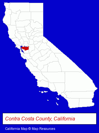
The California counties map at upper right shows Contra Costa County, highlighted in red. Use the menu below to display interactive maps of Danville, either in a frame on this page or in full-screen mode.
Use the menu below to display categorized Danville directories.
| Danville Products and Services Directory | ||
|---|---|---|
| Business Services | Dentists | Pizza Restaurants |
| Printing and Publishing | Restaurants | |
Selected Danville, California Listings
These randomly selected Danville listings provide some insight into the town's cultural environment and economic climate.- Accountants
- Public Accountants
- Certified Public Accountants
- Management Consultants
- Business Management Services
- Association Management Consultants
- Physicians & Surgeons
- Optometrists
- Weddings
- Florists
- Wedding Services
- Wedding Equipment & Supplies
- Wedding Equipment & Supplies Retail
- Sports & Recreation Facilities
- Private Golf Courses
- Private Golf Clubs
- Public Tennis Courts
- Private Tennis Courts
- Dermatology Physicians & Surgeons
- Clothing Stores
- Clothing & Accessories Retail
- Consignment Services & Shops
- Building Materials & Supplies Dealers
- Door & Window Dealers
- Management Consultants
- Business Management Services
- Advertising
- Marketing Consultants
- Clinics & Medical Centers
- Veterinarians
- Animal Hospitals
- Animal Health
- Performing Arts Schools
- Music Instruction
- Art Schools
- Music Teachers
- Investment Services
- Business Consultants & Advisors
- Management Consultants
- Business Management Services
- Veterinarians
- Animal Health
Nearby California Cities and Towns *
- Concord (22) - Concord, California solutions directory and maps.
- Dublin (6) - Dublin, California demographics and maps.
- Hayward (17) - Hayward, California solutions directory and maps.
- Lafayette (7) - Lafayette, California demographics and maps.
- San Leandro (12) - San Leandro, California demographics and directory.
- San Ramon (13) - San Ramon, California demographics and directory.
- Walnut Creek (26) - Walnut Creek, California solutions directory and maps.
* Parenthesized numbers indicate economic activity levels.
Copyright © 2011-2026 RegionalDirectory.us. All rights reserved.