San Leandro, California Map and Directory
Regional Directory > States Menu > California
 According to the United States Census Bureau, San Leandro is a City that is located in Alameda County, California at 37.72 degrees North and 122.16 degrees West.
The city's time zone is America/Los Angeles, and the city's primary telephone area code is 510.
The land area of San Leandro is about 13.35 square miles, whereas the water area of the city is about 2.19 square miles.
Alameda County's land area is about 739 square miles, so the city occupies about 1.8 percent of the county's total land area.
According to the United States Census Bureau, San Leandro is a City that is located in Alameda County, California at 37.72 degrees North and 122.16 degrees West.
The city's time zone is America/Los Angeles, and the city's primary telephone area code is 510.
The land area of San Leandro is about 13.35 square miles, whereas the water area of the city is about 2.19 square miles.
Alameda County's land area is about 739 square miles, so the city occupies about 1.8 percent of the county's total land area.
The Census Bureau estimates that San Leandro had about 88,815 residents in 2019, which is approximately 6,653 people per square mile of land area.
According to recent American Community Survey data, the median household income in San Leandro was about $78,003 per year.
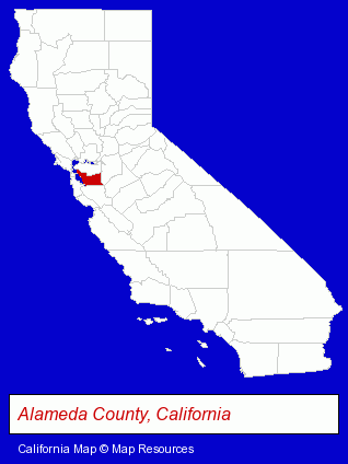
The California counties map at upper right shows Alameda County, highlighted in red. Use the menu below to display interactive maps of San Leandro, either in a frame on this page or in full-screen mode.
Use the menu below to display categorized San Leandro directories.
| San Leandro Products and Services Directory | ||
|---|---|---|
| Auto Service | Building Materials | Clinics |
| Home Improvement | Metals | Movers |
| Physicians | Printing and Publishing | Restaurants |
| Roofing Contractors | Schools | Veterinarians |
Selected San Leandro, California Listings
These randomly selected San Leandro listings provide some insight into the city's cultural environment and economic climate.- Land Surveyors
- Surveyors
- Surveying Services
- Land Surveyors Commercial
- Environmental Services
- Cosmetic & Reconstructive Surgeons
- Surgeons
- Otolaryngology Physicians & Surgeons
- Real Estate Inspection Services
- Home & Building Inspection
- Mold & Mildew Prevention, Inspection & Removal
- Foundation Inspection
- Printing Services
- Commercial Printing
- Computer Printers
- Computer Supplies, Parts & Accessories
- Industrial Equipment & Supplies Dealers
- Optical Goods Retail
- Opticians
- Optical Goods Wholesalers & Manufacturers
- Oncology Physicians & Surgeons
- Mental Health
- Clinics
- Mental Health Practitioners
- Mental Health Clinics
- Upholstery Fabrics Retail
- Office Furniture & Equipment Dealers
- Office Furniture & Equipment Wholesale & Manufacturers
- Builders & Contractors
- Building Contractors
- Sign Dealers
- Signs Wholesale & Manufacturers
- Commercial Signs
- Sign Installation & Hanging
- Optometrists
- Meats Retail
- Meats Wholesale
- Meats
Nearby California Cities and Towns *
- Alameda (6) - Alameda, California demographics and maps.
- Danville (5) - Danville, California demographics and maps.
- Emeryville (7) - Emeryville, California demographics and maps.
- Hayward (17) - Hayward, California solutions directory and maps.
- Lafayette (7) - Lafayette, California demographics and maps.
- Oakland (49) - Oakland, California products & services directory.
- San Ramon (13) - San Ramon, California demographics and directory.
* Parenthesized numbers indicate economic activity levels.
Copyright © 2011-2026 RegionalDirectory.us. All rights reserved.