Goleta, California Map and Directory
Regional Directory > States Menu > California
 According to the United States Census Bureau, Goleta is a City that is located in Santa Barbara County, California at 34.44 degrees North and 119.83 degrees West.
The city's time zone is America/Los Angeles, and the city's primary telephone area code is 805.
The land area of Goleta is about 7.85 square miles, whereas the water area of the city is about 0.07 square miles.
Santa Barbara County's land area is about 2,735 square miles, so the city occupies about 0.3 percent of the county's total land area.
According to the United States Census Bureau, Goleta is a City that is located in Santa Barbara County, California at 34.44 degrees North and 119.83 degrees West.
The city's time zone is America/Los Angeles, and the city's primary telephone area code is 805.
The land area of Goleta is about 7.85 square miles, whereas the water area of the city is about 0.07 square miles.
Santa Barbara County's land area is about 2,735 square miles, so the city occupies about 0.3 percent of the county's total land area.
The Census Bureau estimates that Goleta had about 30,911 residents in 2019, which is approximately 3,938 people per square mile of land area.
According to recent American Community Survey data, the median household income in Goleta was about $98,005 per year.
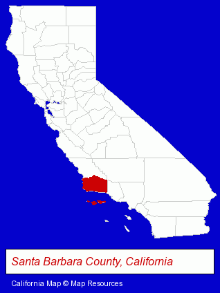
The California counties map at upper right shows Santa Barbara County, highlighted in red. Use the menu below to display interactive maps of Goleta, either in a frame on this page or in full-screen mode.
Use the menu below to display categorized Goleta directories.
| Goleta Products and Services Directory | ||
|---|---|---|
| Auto Service | Building Materials | Clinics |
| Schools | ||
Selected Goleta, California Listings
These randomly selected Goleta listings provide some insight into the city's cultural environment and economic climate.- Auto Oil & Lube
- Auto Inspection
- Auto Emissions Testing & Repair
- Auto Transmissions
- Auto Oil & Lube
- Auto Machine Shop Equipment & Supplies
- Computer Software
- Software Design & Development
- Industrial Equipment & Supplies Wholesale & Manufacturers
- Concrete Contractors
- Construction Machinery & Equipment Dealers
- Construction Machinery & Equipment Wholesale & Manufacturers
- Heavy Construction Equipment Dealers
- Marine Professionals & Services
- Boat Service & Repair
- Ship Building & Repair
- Electric Equipment & Supplies Dealers
- Electronic Equipment & Supplies Wholesale & Manufacturers
- Electronic Component Manufacturers
- Public Schools
- Nurseries
- Plants & Trees Retail Nurseries
- Engineers
- Laboratories
- Research & Development Laboratories
- Research & Development Services
- Auto Body Repair & Painting
- Auto Customizing, Conversion & Restoration
- Custom Auto Painting
- Attorneys
- Corporate Business Attorneys
- Estate Planning & Administration Attorneys
- Civil Law Attorneys
- Dentists
- Pediatrics Dentists
- Computer Consultants
- Computers & Equipment Repair & Maintenance
- Computer Systems Consultants & Designers
- Information Systems Consultants
Nearby California Cities and Towns *
- Camarillo (12) - Camarillo, California demographics and directory.
- Carpinteria (1) - Carpinteria, California information and maps.
- Ojai (3) - Ojai, California information and maps.
- Oxnard (19) - Oxnard, California solutions directory and maps.
- Santa Barbara (39) - Santa Barbara, California products & services directory.
- Santa Maria (7) - Santa Maria, California demographics and maps.
- Solvang (2) - Solvang, California information and maps.
* Parenthesized numbers indicate economic activity levels.
Copyright © 2011-2026 RegionalDirectory.us. All rights reserved.