Monterey, California Map and Directory
Regional Directory > States Menu > California
 According to the United States Census Bureau, Monterey is a City that is located in Monterey County, California at 36.60 degrees North and 121.89 degrees West.
The city's time zone is America/Los Angeles, and the city's primary telephone area code is 831.
The land area of Monterey is about 8.67 square miles, whereas the water area of the city is about 3.58 square miles.
Monterey County's land area is about 3,281 square miles, so the city occupies about 0.3 percent of the county's total land area.
According to the United States Census Bureau, Monterey is a City that is located in Monterey County, California at 36.60 degrees North and 121.89 degrees West.
The city's time zone is America/Los Angeles, and the city's primary telephone area code is 831.
The land area of Monterey is about 8.67 square miles, whereas the water area of the city is about 3.58 square miles.
Monterey County's land area is about 3,281 square miles, so the city occupies about 0.3 percent of the county's total land area.
The Census Bureau estimates that Monterey had about 28,178 residents in 2019, which is approximately 3,250 people per square mile of land area.
According to recent American Community Survey data, the median household income in Monterey was about $80,694 per year.
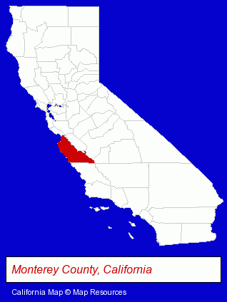
The California counties map at upper right shows Monterey County, highlighted in red. Use the menu below to display interactive maps of Monterey, either in a frame on this page or in full-screen mode.
Use the menu below to display categorized Monterey directories.
| Monterey Products and Services Directory | ||
|---|---|---|
| Accountants | Architects | Attorneys |
| Business Services | Clinics | Financial Services |
| Hotels | Physicians | Printing and Publishing |
| Photographers | Restaurants | Visual Arts |
Selected Monterey, California Listings
These randomly selected Monterey listings provide some insight into the city's cultural environment and economic climate.- Investment Services
- Investment Advisory Services
- Civil Engineers
- Rehabilitation Services
- Rehabilitation Centers
- Nursing & Convalescent Homes
- Public Accountants
- Certified Public Accountants
- Optometrists
- Contact Lenses
- Lodging
- Hotels
- Bed & Breakfasts
- Bed & Breakfast Reservations
- Radio Stations
- Television Stations
- Lodging
- Hotels
- Motels
- Bed & Breakfasts
- Bed & Breakfast Reservations
- Optometrists
- Surgeons
- Orthopedics Physicians & Surgeons
- Lodging
- Hotels
- Bed & Breakfasts
- Bed & Breakfast Reservations
- Art Galleries & Dealers
- Medical Equipment & Supplies Retail
- Medical Equipment & Supplies Wholesale & Manufacturers
- Auto Body Repair & Painting
Nearby California Cities and Towns *
- Aptos (3) - Aptos, California information and maps.
- Capitola (3) - Capitola, California information and maps.
- Pacific Grove (4) - Pacific Grove, California information and maps.
- Salinas (15) - Salinas, California demographics and directory.
- Santa Cruz (42) - Santa Cruz, California products & services directory.
- Seaside (4) - Seaside, California information and maps.
- Watsonville (6) - Watsonville, California demographics and maps.
* Parenthesized numbers indicate economic activity levels.
Copyright © 2011-2026 RegionalDirectory.us. All rights reserved.