Petaluma, California Map and Directory
Regional Directory > States Menu > California
 According to the United States Census Bureau, Petaluma is a City that is located in Sonoma County, California at 38.23 degrees North and 122.64 degrees West.
The city's time zone is America/Los Angeles, and the city's primary telephone area code is 707.
The land area of Petaluma is about 14.38 square miles, whereas the water area of the city is about 0.11 square miles.
Sonoma County's land area is about 1,576 square miles, so the city occupies about 0.9 percent of the county's total land area.
According to the United States Census Bureau, Petaluma is a City that is located in Sonoma County, California at 38.23 degrees North and 122.64 degrees West.
The city's time zone is America/Los Angeles, and the city's primary telephone area code is 707.
The land area of Petaluma is about 14.38 square miles, whereas the water area of the city is about 0.11 square miles.
Sonoma County's land area is about 1,576 square miles, so the city occupies about 0.9 percent of the county's total land area.
The Census Bureau estimates that Petaluma had about 60,520 residents in 2019, which is approximately 4,209 people per square mile of land area.
According to recent American Community Survey data, the median household income in Petaluma was about $91,528 per year.
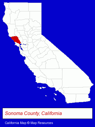
The California counties map at upper right shows Sonoma County, highlighted in red. Use the menu below to display interactive maps of Petaluma, either in a frame on this page or in full-screen mode.
Use the menu below to display categorized Petaluma directories.
| Petaluma Products and Services Directory | ||
|---|---|---|
| Animal Hospitals | Antiques | Architects |
| Auto Service | Building Contractors | Building Materials |
| Chiropractors | Dentists | Home Improvement |
| Metals | Printing and Publishing | Photographers |
| Restaurants | Schools | Steak Restaurants |
| Truck Dealers | Visual Arts | |
Selected Petaluma, California Listings
These randomly selected Petaluma listings provide some insight into the city's cultural environment and economic climate.- Antique Repair & Restoration
- Building & Home Construction
- Architects
- Architectural Services
- Building & Home Construction
- Architects
- Architectural Services
- Furniture Stores
- Cabinet Dealers
- Cabinets & Cabinet Makers Residential
- Pet Care Services
- Pet Grooming & Boarding
- Pet Sitting & Day Care
- Pet Related Services
- Engineers
- Electrical Engineers
- Business Education
- Photography
- Professional Photographers
- Portrait Photographers
- Dermatology Physicians & Surgeons
- Preschools & Kindergartens
- Private Schools
- Educational Services
- Educational Administration
- Photography
- Professional Photographers
- Portrait Photographers
- Office Supplies Retail
- Office Furniture & Equipment Dealers
- Labeling Equipment & Supplies
- Labels & Tags
- Sports & Fitness Instruction
- Water Sports
- Swimming Instruction
- Architectural Engineers
- Excavation Contractors
- Cultural Attractions, Events & Facilities
- Libraries
- Gift Shops
- Gift Baskets & Packs Retail
Nearby California Cities and Towns *
- Novato (14) - Novato, California demographics and directory.
- Rohnert Park (3) - Rohnert Park, California information and maps.
- San Anselmo (2) - San Anselmo, California information and maps.
- San Rafael (29) - San Rafael, California solutions directory and maps.
- Santa Rosa (66) - Santa Rosa, California products & services directory.
- Sebastopol (7) - Sebastopol, California demographics and maps.
- Sonoma (11) - Sonoma, California demographics and directory.
* Parenthesized numbers indicate economic activity levels.
Copyright © 2011-2026 RegionalDirectory.us. All rights reserved.